Events

MapAttack Weekend Timelapse Footage!
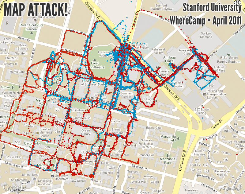
Aaron Parecki created a visualization of the territory captured by each team during gameplay. Below is a visualization of the GPS trails of the players during the games. Each dot represents a snapshot of the position of each player taken every 1-10 seconds.

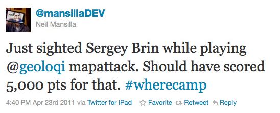
Some of the players experienced interesting events, such as seeing a marching band with Stanford students dressed as pine trees play on campus. Another player found something even more interesting:
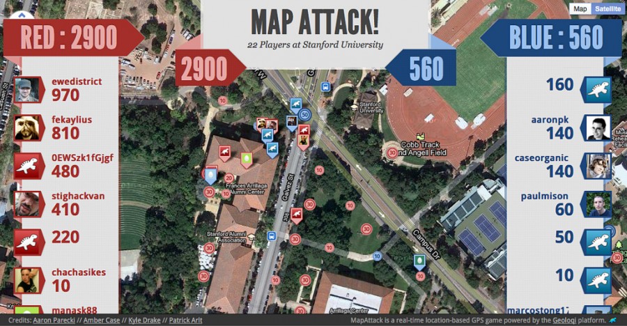
Final Game Results

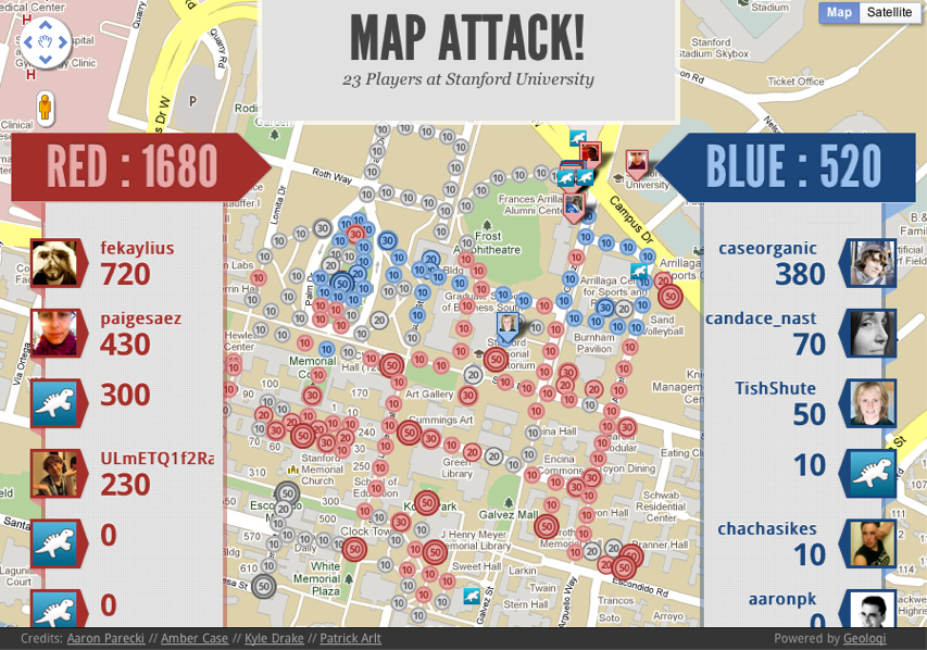
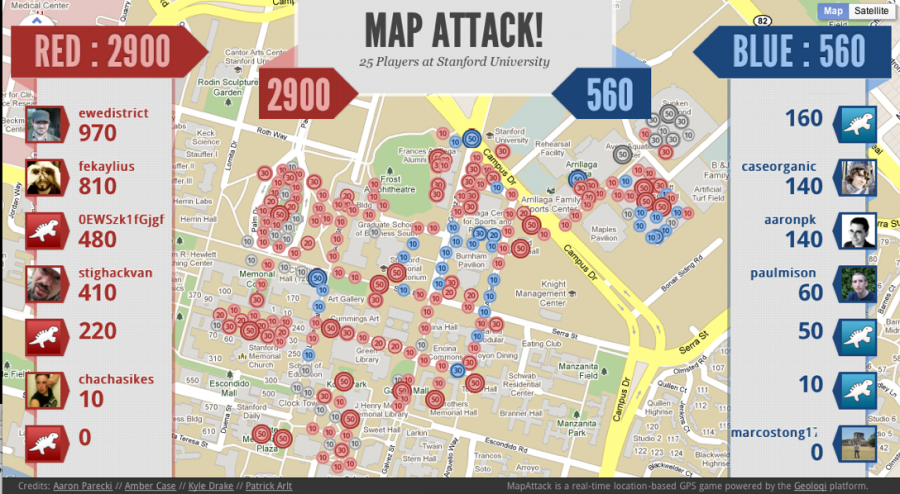
Again, red completely won over blue! It was an epic battle filled with kids and bikes and many points.

You can see a replay of the games in the video below!

MapAttack at WhereCamp 2011 from aaronpk on Vimeo. Thanks to Sam Churchill for contributing video footage!

Bring MapAttack to your city, school or company!

Want to bring a game to your school or company? Contact us at mapattack at geoloqi dot com or here and we’ll be glad to help you out! You can also follow @playmapattack on Twitter for the latest games and news! We’ll be bringing it to more campuses and cities starting in June 2011.

Giant Thanks!

Again, giant thanks to Aaron Parecki and Kyle Drake for development and Patrick Arlt for design. Enormous thanks to Reid Beels and Audrey Eschright for helping keep the server stable during Friday’s game! Making a game like this has been a dream of mine since WhereCamp Portland 2008. It’s great to see it come to life!
Posted

Fri Apr 22 2011, 3:15pm

By caseorganic

Categories

Events

Tagged

Results from the MapAttack at Stanford University!

This morning a bunch of us at WhereCamp headed out to play MapAttack, a game based on the Geoloqi platform. Players subscribed to the MapAttack layer in the Geoloqi app and were assigned to a red or blue team. 

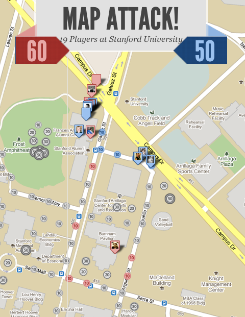
The game quickly progressed as people rushed out to collect dots. Some, riding on bikes, grabbed points faster than others. Others, like @paigesaez, aimed for large points, finding and capturing 50 point dots before anyone else.

Mobile App

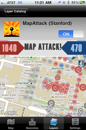
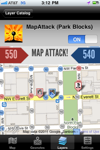
Here’s what the MapAttack game looked like on the phone. The leaderboard updated in real time, and everyone’s locations and movements could be seen. The fierce battle between red and blue teams progressed over time.

A Rush to the Finish

Red dominated in the lead over Blue through most of the game.

One of the players who got most of the red team’s points on the map told us a story of how one of the points was stuck in the middle of a construction site. He went up the construction worked and asked him if he could carry the phone into the site and hold it there until the point was received. That led to an interesting discussion on real-life apps and games between him and the worker. Had he not been playing the game, he would not have had the conversation or even talked to the worker.

Red won the game! You can see the end state of the game here!

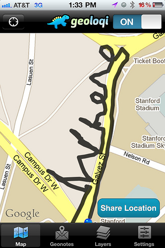
Drawing pictures with GPS

@mpanighetti and @aaronpk went out to draw the word Where on a part of the Stanford University campus. They cranked up the tracker and ran around in the shape of the word.

There have been a bunch of pieces of GPS art created with the Geoloqi app. If you have one, send it to us at art at geoloqi dot com! We’ll put it up in a gallery in the future!
Thanks a bunch!
Thanks to everyone who played and worked on the app. We can’t wait to improve it and bring it to more people! You can keep up on future games by following @playmapattack.

Geoloqi launches MapAttack! a real-time location-based mobile gaming platform of awesomeness.

What is MapAttack?

MapAttack is a real-time location-based GPS game running on the @geoloqi platform. Coming to a city near you.

Behind MapAttack is Geoloqi’s powerful location-messaging platform and our new gaming platform that can scale up to handle hundreds of thousands of parallel users.

Why MapAttack?

So you can turn the real world into a game, of course! To get to run around while doing awesome things and have fun! The feeling while playing a real-life game is one of the best things on earth. It’s not common, but it’s becoming an increasingly awesome possibility with mobile technology. We hope millions of these games occur and that we can make more of them possible. We’re always inspired by Jane McGonigal and AreaCode and we’d like to increase our ability to bring more people into real-world gaming.

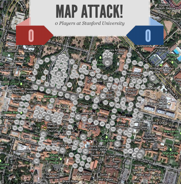
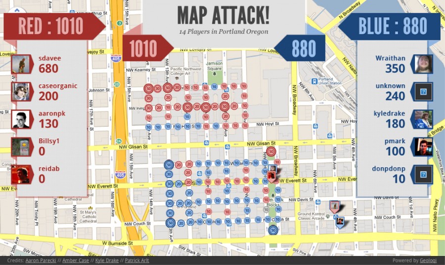
We did the first beta test of MapAttack at the Park Blocks in downtown Portland, Oregon today. As you can see, the map was filled with dots of various values, all of which were quickly eaten:


Thanks so much to Pat Arlt for the excellent design and CSS for this gamemap. The map intelligently shrinks and grows based on browser-window size. Check it out!

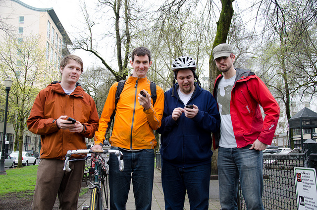
Some of the MapAttack players!

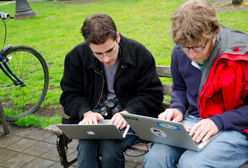
Last minute bug fixing…

Aaron Parecki and Kyle Drake furiously worked on a last-minute OAuth2 issue before everyone could join. This lightning-fast park bench programming is brought to you by tethered Android phones!

Photo credit @reidab
Thanks to @reidab for the photos!

Gameplay

The experience of playing MapAttack was a unique one. Similar to playing Pac Manhattan at WhereCamp Portland in 2008, the Park Blocks and Pearl District became something more than just a series of streets. When the game was running we were all motivated to explore and gather points by a very different drive than simply walking down the street. It was a completely wonderful and intense feeling.

How a real-life game feels can’t be fully described unless you have played a real-time alternate reality game. There’s something behind these types of experiences, and that’s why it’s been so exciting to build this type of game.

Video

Here’s a short video of @caseorganic explaining the game. Thanks to Sam Churchill of dailywireless.org for taking the video on our first day of testing!

What Next? MapAttack at WhereCamp and Colombia!

After we speak at Where2.0 next week, we’ll be bringing the game to Stanford University where we’ll be bringing MapAttack to WhereCamp. Our first international remote game will be in Medellín, Colombia later this summer.

There’s going to be a lot more!

You can follow MapAttack on Twitter for updates and if you’d like to ask us questions about how to use the platform to make your own games. We’ll have a game-editor and game system set up after we get back from Stanford! See you soon!

Thanks a ton!

Giant enormous thanks go to Aaron Parecki, Kyle Drake and Pat Arlt for making this game come to life. Want MapAttack in your city? Let us know below!

Posted

Mon Nov 22 2010, 11:11am

By caseorganic

Categories

Events

Tagged

Building a Location-Based Science Trivia Game with Geoloqi at Science Hack Day, San Francisco

Last week, the Geoloqi team headed down to Palo Alto last week for Science Hack Day, a 48 hour hacking event that brought together scientists and technologist, artists and futurists, for a weekend of development, gaming and overall enjoyment. Many of us slept at the event, while some stayed up hacking into the night.

We arrived at Science Hack Day with the goal of making an experience that gets people to pay attention to the world around them. During gameplay, players walk around town and receive location-based questions via SMS related to education and science and their nearby location.

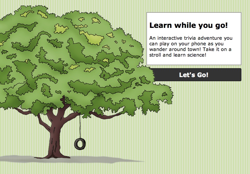
Location-based science trivia game at Science Hack Day

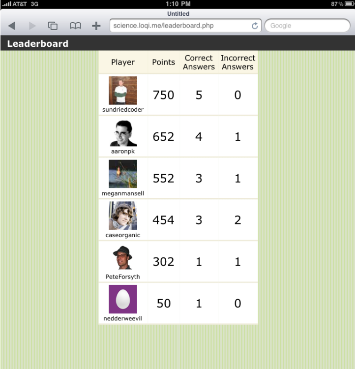
Each question was worth points, and more points are awarded for correct responses than incorrect responses. Those with the highest scores are listed on a leaderboard.

Science Notes Leaderboard

Players used a GPS Tracker made by Instamapper to play the game.

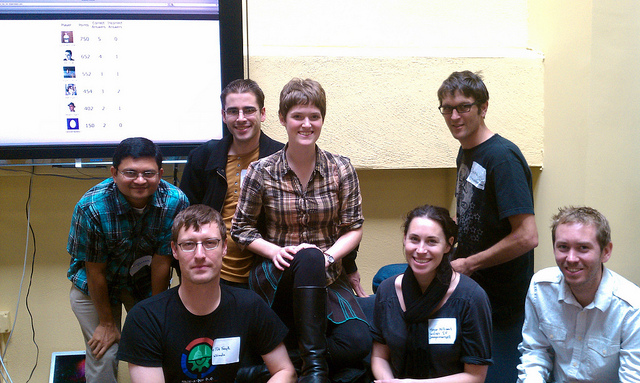
Science Hack Day Team Geoloqi

Thanks to all those who helped us with development and testing! Kevin Rohling, Liam Holt, Megan Mansell, Devin Drew, Pete Forsyth, Ashish Mahabal and Jennifer Monfrans.

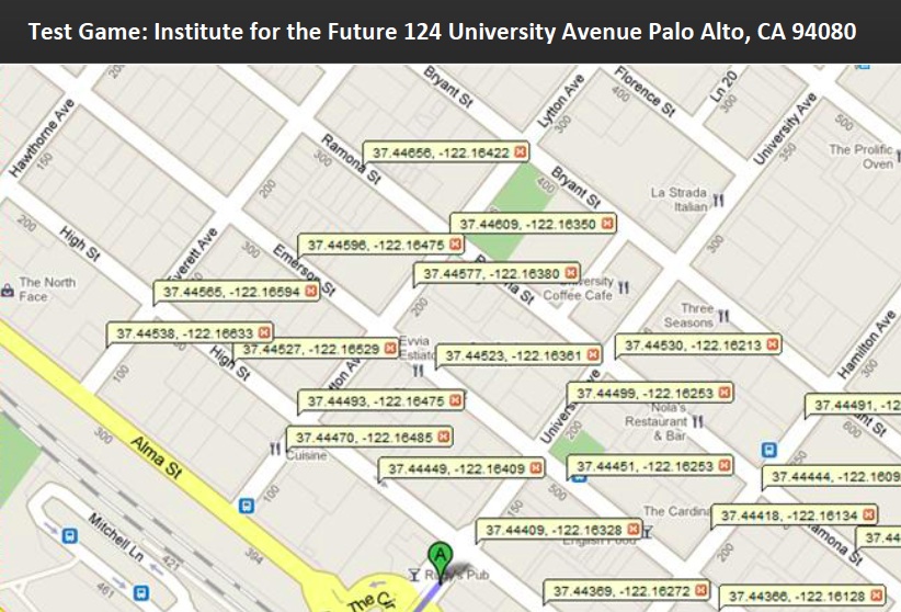
Test Game Lat Long Markers

We left questions at a number of locations around the Institute for the Future, where the conference was being held.

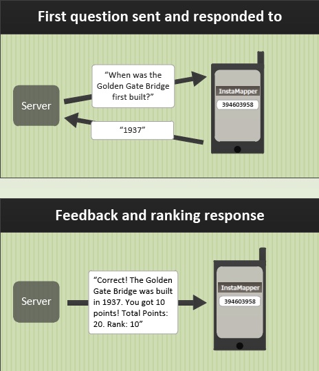
Question Response

Questions and Responses

Questions were sent to a player’s phone by SMS, and they were given points based on their response. Most questions dealt with the area right around the user.

To respond, the player simply send a reply back to the SMS number and the database checked whether the response was correct or not and added points to the user’s id.

Application Architecture

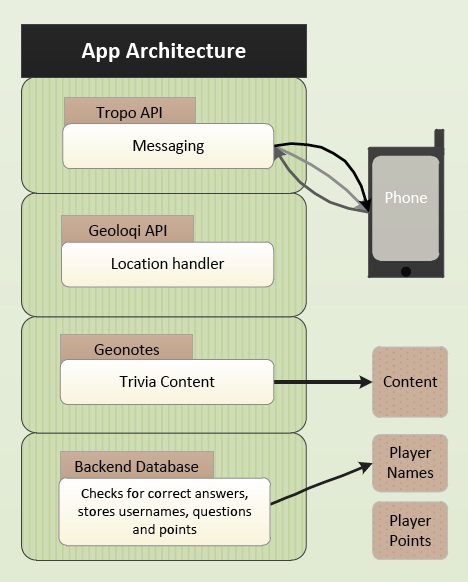
Application Architecture

We used the Tropo API to send the SMS messages to users as they walked around town.

Geoloqi acted as the location-handler, determining where players were.

Finally, the trivia content was stored in a database built by Kevin Rohling.

Player ids and point tallies were handled there and displayed on the leaderboard.

Thank You!

Thanks again to everyone who joined in the game! It made Science Hack Day a blast. Thanks to Ariel Waldman for organizing it, and Jeremy Keith for coming up with the concept in the first place.

Posted

Sun Oct 3 2010, 10:22pm

By Aaron Parecki

Categories

Events

Tagged

Apps built at the Tropo + Geoloqi Open Gov Hackathon


Thanks to everyone who came out to the Open Gov Hackathon today! We’re proud to announce the winners! The best app using the Tropo API went home with a Sonos Wireless Music System, and the best app using the Geoloqi API went home with an iPad!

The judging began at 6:30Pm, and everyone stopped programming. After all of the presentations were done, we discussed each app with the Tropo team and Rick Nixon of CivicApps. It was a tough decision, as the entries were extremely creative and useful!

Thanks to everyone who watched, participated, and cheered on the developers. We owe the greatest thanks to Tropo and the City of Portland, who were great supporters of the event. This won’t be the last hackathon. We will be doing this again in the future as soon as possible. If you’re interested in partnering with us for another hackathon, let us know!

Heritage Tree Quest

Winner: Best use of Tropo by @trisimon

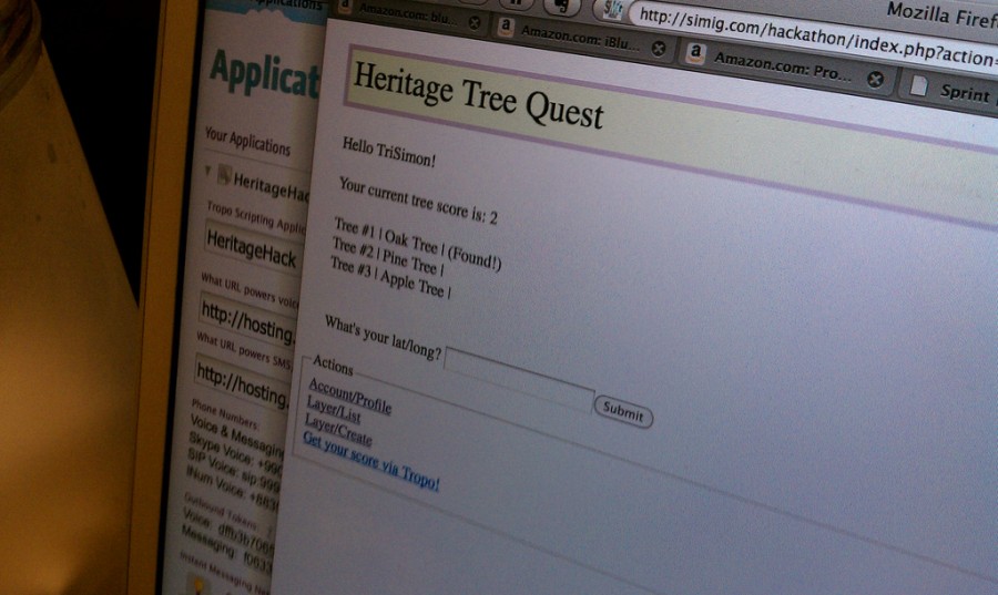
Like PacMan for heritage trees! You go around town finding trees and collecting points. You get bonus points for collecting all trees in a neighborhood. You receive your score via an SMS from Tropo. When you’re near a tree, you can call Tropo and it will quiz you to identify it, getting you even more points! It was this clever use of the voice recognition capabilities of Tropo that made this application stand out.

Don’t Eat That!

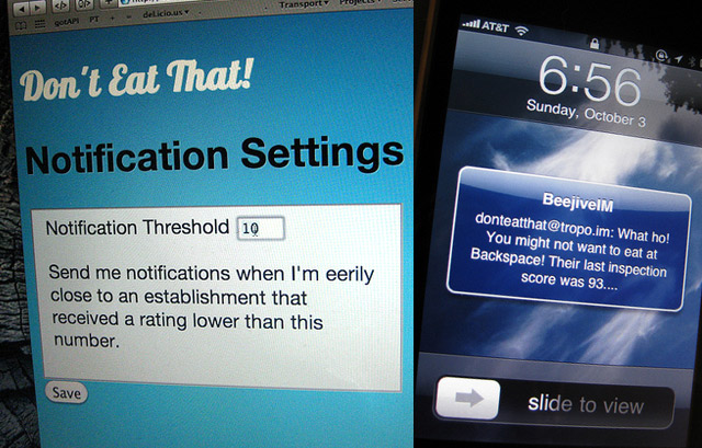
Winner: Best use of Geoloqi by @reidab

“Don’t Eat That!” pulls health inspections from the county web page. If you use Geoloqi, you can subscribe to notifications of scores under a certain threshold for restaurants within 100 meters of your current location. You’ll get an SMS that says “What ho! You might not want to eat at Backspace, their last inspection score was 93!” That way you can gawk at dirty restaurants near you! This app will also post links to the reports as tips on Foursquare!

BarBird

Honorable Mention. Finds all the bars in the business license dataset and matches them to Twitter feeds by searching Twitter lists. The map shows notification icons on the map and shows the latest tweets from every bar. A future mobile version could use the Geoloqi API to track your location and receive Geonotes for specials at bars near you.

Tweedopt.com

Honorable Mention. Finds pets available for adoption from the Multnomah County Animal Services database and petfinder.com. You can read the descriptions of the animals and send out a tweet for them. Using the Tropo API, the non-technical foster homes can call in and ask for a short update about the pet, so the shelters aren’t required to know how to use Twitter. On “Woof Wednesday” the dogs that are looking for homes will tweet their latest updates or a random pet.
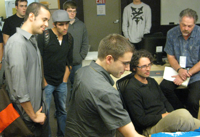
We are thrilled that everyone was excited to come out and join us for a day of hacking! And special thanks to Tropo for co-sponsoring the event and to CivicApps for the great support.