Posts Tagged ‘api’

Posted

Mon Aug 19 2013, 10:10am

By Aaron Parecki

Categories

API

Tagged

Changes to Location History Storage for Geoloqi developers
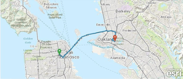
Geoloqi is all about the real-time location data that supports the Geotrigger service, but we’ve been filling up cloud after cloud with extra data we realized our customers don’t really use.

Going forward, we will stop storing the raw location data points, and instead store the trigger history only – that is, the timestamp and latitude/longitude when a trigger is fired. New Geoloqi apps created after August 13, 2013 will not store location history, and in 30 days we will stop storing new location history for existing Geoloqi apps.

How will this affect my app(s)?

Odds are, it won’t. Unless your app needs to retrieve more than the last known location of a device, you shouldn’t notice a thing. Nothing besides location history is changing.

What if historical location data is important to me?

Do you currently use or plan on using your app’s historical location data? We can turn it on/leave it on for an additional charge/fee (as our normal pricing is just for our Geotrigger Service). Just let us know!

Exceptions

One of our customers uses Geoloqi to track where their app users are located currently, to send them Geotriggered messages, and to look at historical data on where they went, so we will continue storing historical location data for them and others on a case by case basis. The vast majority of our customers only need Geoloqi’s core technologies for their apps: Geotriggers, real-time location tracking, and geocoding.

What’s next?

We’re currently working on an updated version of the Geoloqi platform and an entire re-haul of the API. We aim to make the API easier to use, easier to get started, and require fewer API calls to run. In addition, we’re improving battery life, accuracy and stability of the platform as the number of devices, customers and users of our system grows. Over time, we’ll also be releasing special Geotrigger tools for ArcGIS users and customers, too! We’ll let you know when we’re ready to launch! Once the new API and SDKs are launched, we’ll be publishing a migration and update guide for existing customers, and will begin a wind-down of of the original service. We will provide at least one year (if not more) for all apps to update their SDKs to the new service.

Thanks!

Thanks so much for being a Geoloqi customer or considering using Geoloqi for your apps! We’re here to serve you, so if you have any questions, just let us know!

Posted

Wed May 15 2013, 12:12pm

By Aaron Parecki

Categories

News

Tagged

Here’s why we’re excited about the new Android Location APIs

The ArcGIS Geotrigger Service leverages the latest Android and iPhone technology, when these services improve, our technology improves. Our goal is to make the best cross-platform location services for developers, leveraging the best capabilities of the native location services available for existing consumer devices.

On the iPhone, we’ve leveraged the native geofencing APIs to offer improved battery life compared to using the GPS directly. On Android, there have been minimal location services available from the SDK, essentially limited to turning the raw GPS device on or off.

Three new location APIs were announced today at Google I/O. This is great news for anyone building location-based applications. We’ve been eager for Google to improve the Android location services.

Fused Location Provider

The Fused Location Provider utilizes all of the communication sensors in the phone including wifi, GPS, and cell network, while using only 1% of the battery that previous APIs used.

This is a new service that will greatly improve any application that uses location services. We will improve the ArcGIS Geotrigger SDK for Android significantly by taking advantage of the new Location Provider. Expect to see much better battery life on the Android Geotrigger SDK in the future!

Geofencing

The new Google Geofencing APIs allow apps to respond to the user entering or exiting a configured geofence. The API allows each app to define 100 geofences simultaneously.

This is great news for the ArcGIS Geotrigger SDK, since we will be able to leverage this service to provide better battery life and performance in the SDK. Previously we were limited to turning on and off the GPS device. Now we will be able to use the geofencing API in combination with our optimization algorithms to better provide our Geotrigger service.

Activity Recognition

The new Activity Recognition API uses machine learning classifiers to determine whether the user is walking, cycling or driving. Apps will be able to adjust their behavior depending on the user’s mode of transport. This is done in a very battery efficient way, no GPS is required.

We will leverage this new API to make further improvements to managing the native location services, and it should open up possibilities for some interesting new apps to be built.

The ArcGIS Geotrigger Service

The ArcGIS Geotrigger Service allows developers to easily manage Geotrigger rules with a simple cloud-based API, while also supporting geofences defined as polygons. You can configure an essentially unlimited number of Geotrigger rules in the API, and only the nearby ones will be synced to the phone, making it easy to handle the limitations of the native APIs.

Many of the battery life issues people experience are due to poor implementations of using the Apple and Android location services. It’s easy for a developer to leave the GPS on all the time, but that drains battery quickly. The Geotrigger SDK efficiently manages the native location services and optimizes the server communication required to send location data, saving battery life wherever possible.

The improvements to the Android location APIs are fantastic news and will result in improved Geotrigger services and a better experience for developers!


Aaron Parecki
CTO, Esri R&D Center, Portland

Amber Case
Director, Esri R&D Center, Portland

Posted

Tue Jan 8 2013, 4:16pm

By caseorganic

Categories

Events

Tagged

Esri/Geoloqi/Foursquare Hackathon Recap from San Francisco!

Geoloqi/Esri had a great time at the Foursquare Hackathon this weekend! Not only did tons of people show up to hack (over 200 globally, 100 at the NYC office, and around 50 at the SF office), we got to hang out with our friends Jim Young and Bronwyn Agrios from Esri’s SF office!

Together we built interesting stuff, saw interesting hacks, and met lots of new people.

Kyle Drake shows the output of the NASDAQ API to a hackathon participant

Esri/Geoloqi platform developer Kyle Drake (top right) shows the output of the NASDAQ API to a hackathon participant.

Jim and Bronwyn

Jim Young and Bronwyn Agrios (top right) from the Esri SF get a demo from a fellow hackathon participant.

Winner of the Esri/Geoloqi prize at Foursquare Hackathon

We awarded an iPad prize to Leah Vaughan (second from left) for her great use of an Esri map! Her app was called “Stuck at the Airport”. It recommends interesting places/things to see around you when you’re in transit areas (train satins, airports, rest stops, etc.).

Also, Kyle Drake, Aaron Parecki and I put together a hack using the NASDAQ and Foursquare APIs called NASDAQ Facts (below).

NASDAQ Facts for Foursquare tells you the stock price of every public company you check into. Stock markets are about more than numbers. Discover which places on Foursquare you visit are public companies, get information on how they are doing, and learn more about them by clicking on a link. The information automatically appears on your Foursquare app after checking into a place! (We ended up winning a flying shark for this hack!).

We finished our hacking early, so Kyle Drake hung out in the Foursquare office hammock.

See you next time!

You can see a list of all the Foursquare Hackathon projects here, as well as the local winners and global winners! If you’d like to build cool stuff with us in the future, let us know! Who knows? We may soon be coming to a hack day near you!

Follow us!

(You can find Jim and Bronwyn at SF’s Hatchery!)

Posted

Thu Jan 3 2013, 2:14pm

By Aaron Parecki

Categories

Events

Tagged

Join Geoloqi and Esri at the Foursquare Hackathon in San Francisco!

The Foursquare Hackathon returns this weekend! Come build great connected apps using Geoloqi‘s Geotrigger platform (now a part of Esri!) this Saturday January 5th at Foursquare HQ in SF. Today is the last day to sign up!

View from Foursquare SF Offices

Prizes!

Build something amazing and you might just find yourself ringing the NASDAQ closing bell, rocking tickets to SXSW, partying with an action figure version of yourself, or wearing the infamous foursquare hackathon TITLE BELT.

What tech can you use?

Interested in adding location-based messaging to an app? How about getting an alert when you are around items on you Foursquare todo list? Start with the Geoloqi SDK for iPhone or Android, then max it out with Esri maps, intelligent routing, geocoding and more. Consider what your app could do if it knew where it was all the time then add the awesomeness of Foursquare to the picture.

Check out the other ideas on the Hackathon Wishlist that require alerts based on proximity or dwell time.

Sign Up!

You can get a head start on this weekend by signing up for a free account on developers.geoloqi.com, checking out our GitHub repository github.com/geoloqi, and downloading our sample apps from the Apple or Android app stores (for the frequent flier, try Everyday City which lets you automatically share the cities you visit).

We’ll have folks from our SF and Portland teams there to get you started using the technology and brainstorm great ideas. Hope to see you there.

Posted

Sat Nov 19 2011, 12:12pm

By caseorganic

Categories

Features

Tagged

Geoloqi – Now with GPX Export!

Geoloqi with GPX Export

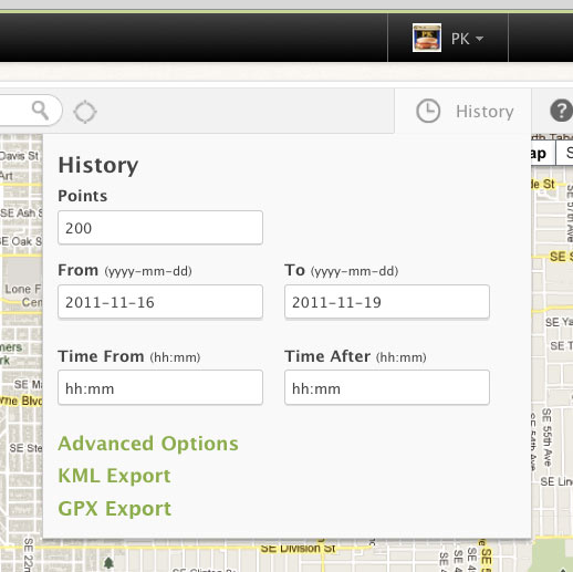
At the request of many, we’ve added GPX Export functionality to data in Geoloqi! Now you can export GPX data from the history tab on the map page in your Geoloqi account, as well as directly from the API.

What is GPX?

GPX (the GPS Exchange Format) is a light-weight XML data format for the interchange of GPS data (waypoints, routes, and tracks) between applications and Web services on the Internet. GPX has been the de-facto XML standard for lightweight interchange of GPS data since the initial GPX 1.0 release in 2002.

Downloading GPX from your profileGeoloqi with KML and GPX Export
Simply log into Geoloqi and click on the History tab.

You’ll see two options: Download KML and Download GPX.

Downloading GPX data from the Geoloqi API
Add location/history.gpx to the end of the call to download GPX.

You can see more history options in the Geoloqi API Documentation.