Posts Tagged ‘geoloqi’

Posted

Sat Jan 14 2012, 12:12pm

By Aaron Parecki

Categories

API
Tutorials

Tagged

Export your places from SimpleGeo Storage to Geoloqi

This tool will allow you to transfer your SimpleGeo Storage data over to Geoloqi. It makes Geoloqi Layers for each SimpleGeo Layer, and converts Records to Geoloqi Places for each of the layers.

All you need to run the command is a Geoloqi Access Token, and the SimpleGEO OAuth Key and Secret. You can sign up for a Geoloqi account at The Geoloqi Web Site and retrieve your access token from the Geoloqi Developers site.

This script is provided as an executable via Rubygems, which means it runs on any Mac OSX computer out-of-the-box (and on any Windows/Linux machines with ruby available).

Installation

Open up a terminal and run this in the command line:

$ gem install geoloqi-simplegeo-import

Usage

Run the script from the command line:

$ geoloqi-simplegeo-import YOUR_GEOLOQI_ACCESS_TOKEN YOUR_SIMPLEGEO_OAUTH_KEY YOUR_SIMPLEGEO_OAUTH_SECRET

The script will output information on the transferred data, and give you a link to our Layer Editor so you can see and edit your Layers and Places (we have a GUI interface for your data!).

Places in Geoloqi

Searching for Nearby Layers and Places

With Geoloqi you can search for nearby layers and places very easily with these two API calls:

You can experiment with running these API calls directly from cURL or from our Developers Console:

We have SDK libraries for Ruby, JavaScript, Node.JS, PHP, and more coming very, very soon.

There is a lot of other stuff you can do with Geoloqi, such as geolocation triggers/callbacks and geo-messaging. Visit our web site to read more about us (and where we’re going).

Bugs

Feel free to file any issues on Github, we will respond to them as soon as possible. If you need any features here we haven’t provided, don’t hesitate to contact us.

TODO

This is a quick-fix solution. However we are planning on making a more stable, complete tool for importing data to Geoloqi from other sources (and for exporting your data out of Geoloqi). We feel it’s in your best interest to have total control of your data at all times, and we want to help you solve problems, including the problem of transferring data between your machine and cloud services.

Posted

Sat Nov 19 2011, 12:12pm

By caseorganic

Categories

Features

Tagged

Geoloqi – Now with GPX Export!

Geoloqi with GPX Export

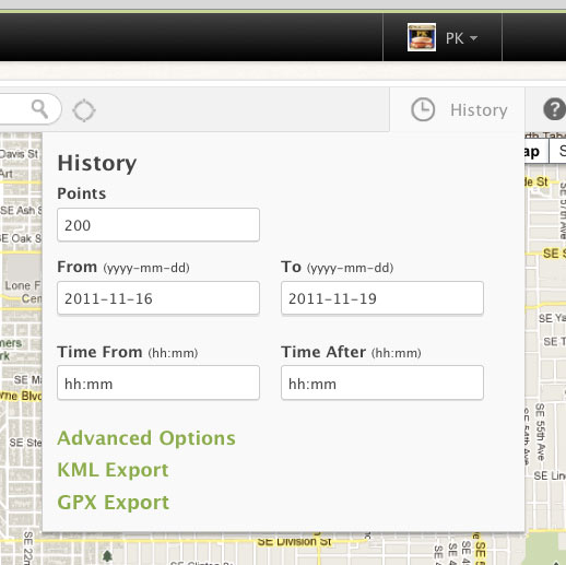
At the request of many, we’ve added GPX Export functionality to data in Geoloqi! Now you can export GPX data from the history tab on the map page in your Geoloqi account, as well as directly from the API.

What is GPX?

GPX (the GPS Exchange Format) is a light-weight XML data format for the interchange of GPS data (waypoints, routes, and tracks) between applications and Web services on the Internet. GPX has been the de-facto XML standard for lightweight interchange of GPS data since the initial GPX 1.0 release in 2002.

Downloading GPX from your profileGeoloqi with KML and GPX Export
Simply log into Geoloqi and click on the History tab.

You’ll see two options: Download KML and Download GPX.

Downloading GPX data from the Geoloqi API
Add location/history.gpx to the end of the call to download GPX.

You can see more history options in the Geoloqi API Documentation.

Geoloqi Developer Kyle Drake to speak on building real-time games at Keeping it Realtime Conference in Portland, Oregon!

We’re happy to announce that on November 7th 2011, Geoloqi’s Kyle Drake will be speaking at the Keeping it Realtime Conference in Portland, Oregon!

Who is Kyle Drake?
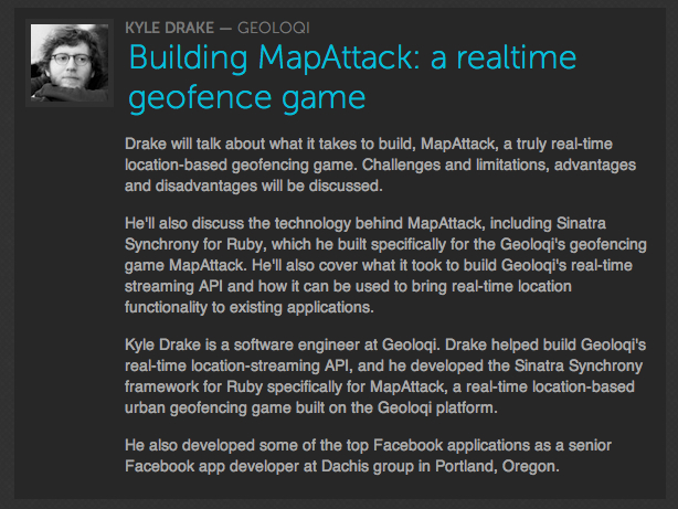
Kyle Drake is a software engineer at Geoloqi. Drake helped build Geoloqi’s real-time location-streaming API, and he developed the Sinatra Synchrony framework for Ruby specifically for MapAttack, a real-time location-based urban geofencing game built on the Geoloqi platform.

He also developed some of the top Facebook applications as a senior Facebook app developer at Dachis Group in Portland, Oregon.

Session Description: Building MapAttack: A Realtime Geofence Game

Drake will talk about what was involved in building MapAttack, a truly real-time location-based geofencing game. Challenges and limitations, advantages and disadvantages will be discussed.

He’ll also discuss the technology behind MapAttack, including Sinatra Synchrony for Ruby, which he built specifically for the Geoloqi’s geofencing game MapAttack. He’ll also cover what it took to build Geoloqi’s real-time streaming API and how it can be used to bring real-time location functionality to existing applications.

What is KRT Conf?

Keeping is Realtime is a conference by developers, for developers with passionate, kickass speakers.
It’s a place where brand new frameworks are unveiled, there’s education for beginners and veterans. It’s a place for diverse perspectives and stacks in a venue structured to maximize discussion. This makes for a series of awesome networking events over the course of two amazing days.

When?

Nov. 7th-8th, 2011 at the Left Bank Annex building in Portland, OR.

Tickets!

Get tickets for Keeping It Realtime

More about MapAttack!

MapAttack is a real-time location-based game built on the Geoloqi platform. You can follow MapAttack! on Twitter at @playmapattack. You can download the MapAttack source code here.

Posted

Wed Aug 31 2011, 2:14pm

By caseorganic

Categories

News

Tagged

Norway’s Hyper Interaktiv Uses Geoloqi for iPhone to Track Balloon Flight 17 km in the Air!

Hyper Interaktiv Team Preparing Balloon Launch

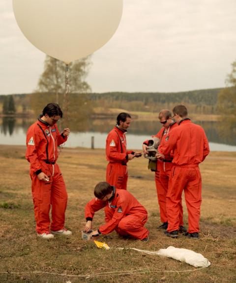
When we heard from Hyper Interaktiv’s Atle Mo (@atlemo) that he had tracked a balloon with Geoloqi and wanted to export the data to Google Earth, Geoloqi co-founder Aaron Parecki whipped a quick KML export feature for the team.

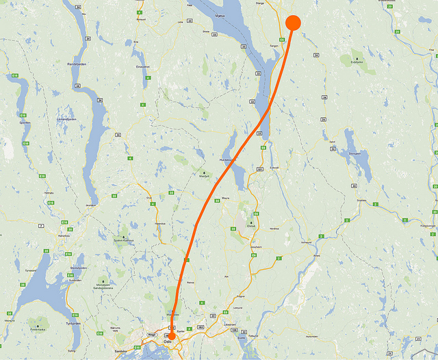
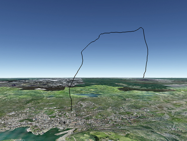
The team was able to track the Balloon’s flight from the ground on the Geoloqi website and were able to use the trail to find the after it came back down to Earth. They also generated a bunch of images of the balloon’s flight using the Geoloqi data.

The Hyper Interactive team launched a high-altitude balloon on August 25th from Oslo, Norway at the Hyper.no office. The balloon was launched in celebration of Hyper’s 10th anniversary. The balloon went up to 17 kilometers in the air before exploding and then floating down to Earth to land in a tree.

Tracking the Balloon with Geoloqi

Balloon's Flight Path as Recorded by Geoloqi

The team used an iPhone 4 with Geoloqi to track the flight and a Hero GoPro HD camera to videotape the flight.

The highest altitude reached was 17,97 km and the travel distance was around 120 km. The team used the Geoloqi website to track the balloon once it touched down!

Google Earth View

Balloon's Flight Path in Google Earth
Atle Mo used Geoloqi’s KML export to view the flight data in Google Earth.

Video of the Flight:

Their video shows the full flight of the balloon. You can see it rise up to 17 km before slowly falling and landing in a tree.

Norwegian publication Dagbladet.no also covered the story if you’d like to learn more about the flight and the team! Also check out Hyper Interaktiv!

Geoloqi wins the mobile showcase at AppNation San Francisco!

Mobile App Competition

This week the Geoloqi team attended APPNATION and presented at AppCircus, a global open app showcase. We learned about the conference from Di-Ann Eisnor and had very little time to prepare our presentation for the event.

Lots of Apps!

The competition had a lot of great ideas and it was wonderful to see them. All were successful apps in many different fields. Our two favorites were GitBax, an app that helps you “get back” to those you meet, and OpenSignalMaps, an app for finding mobile signals around town.

The next morning Geoloqi was called to the stage and awarded a $1,500 cash prize on behalf of APPNATION. Geoloqi was also entered into consideration for a presentation at Mobile World Expo in Barcelona, Spain next year.

APPNATION, San Francisco!

APPNATION was a great conference! We learned a great deal and got to meet a ton of amazing people. The presentations were chock full of information and the expo floor companies were very relevant and useful to talk to. We have Di-Ann Eisnor to thank for telling us about the conference, and the conference organizers for putting on such a great event.

Much more to come!

Thanks to everyone who attended the event, helped us to prepare and supported Geoloqi in general. If you’d like to get news more quickly follow Geoloqi on Twitter!