Posts Tagged ‘maps’

Posted

Tue Jan 8 2013, 4:16pm

By caseorganic

Categories

Events

Tagged

Esri/Geoloqi/Foursquare Hackathon Recap from San Francisco!

Geoloqi/Esri had a great time at the Foursquare Hackathon this weekend! Not only did tons of people show up to hack (over 200 globally, 100 at the NYC office, and around 50 at the SF office), we got to hang out with our friends Jim Young and Bronwyn Agrios from Esri’s SF office!

Together we built interesting stuff, saw interesting hacks, and met lots of new people.
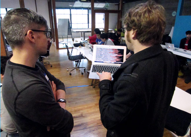
Kyle Drake shows the output of the NASDAQ API to a hackathon participant

Esri/Geoloqi platform developer Kyle Drake (top right) shows the output of the NASDAQ API to a hackathon participant.
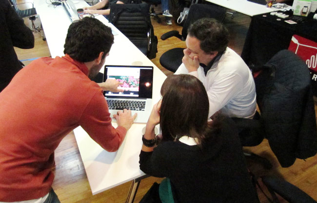
Jim and Bronwyn

Jim Young and Bronwyn Agrios (top right) from the Esri SF get a demo from a fellow hackathon participant.
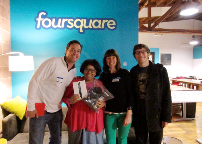
Winner of the Esri/Geoloqi prize at Foursquare Hackathon

We awarded an iPad prize to Leah Vaughan (second from left) for her great use of an Esri map! Her app was called “Stuck at the Airport”. It recommends interesting places/things to see around you when you’re in transit areas (train satins, airports, rest stops, etc.).

Also, Kyle Drake, Aaron Parecki and I put together a hack using the NASDAQ and Foursquare APIs called NASDAQ Facts (below).

NASDAQ Facts for Foursquare tells you the stock price of every public company you check into. Stock markets are about more than numbers. Discover which places on Foursquare you visit are public companies, get information on how they are doing, and learn more about them by clicking on a link. The information automatically appears on your Foursquare app after checking into a place! (We ended up winning a flying shark for this hack!).
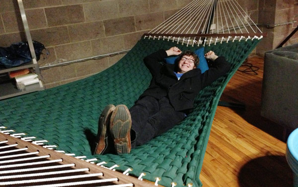
We finished our hacking early, so Kyle Drake hung out in the Foursquare office hammock.

See you next time!

You can see a list of all the Foursquare Hackathon projects here, as well as the local winners and global winners! If you’d like to build cool stuff with us in the future, let us know! Who knows? We may soon be coming to a hack day near you!

Follow us!

(You can find Jim and Bronwyn at SF’s Hatchery!)
Posted

Wed Jul 25 2012, 11:11am

By caseorganic

Categories

Events

Tagged

Geoloqi at ESRI Users Conference 2012

Photo: @kk for ESRI

Hello from San Diego!

This week we sent the entire Geoloqi development team to ESRI’s annual User Conference in San Diego. We all had a great time being around people who enjoy location just as much as we do.

Some of the 15,000 people at the 2012 ESRI User Conference. Photo: @kk for ESRI.

ESRI powers a lot of everyday things that people don’t generally think about. From road planning and civic planning, to emergency response to environmental protection, the presentations were just a small sampling of the many users of ArcGIS and other ESRI tools. With so many applications, it was fun to talk with people about where they wanted to go next. A lot of them were very excited about ambient, adaptive, real-time location.

15,000 people…over 500 sessions!

The conference attracted a whopping 15,000 attendees (compare that to over 20,000 at SXSW Interactive this year). It was more than drinking from a firehose. It was as if each of the sessions was a .zip file that we had to fit into our already crowded brains. Although we only attended three days of the conference, we left feeling completely overwhelmed. It’s going to take a few weeks to process everything we experienced.

Geoloqi Team at the ESRI User Conference 2012

Left to right: Pat Arlt, Kenichi Nakamura, Amber Case, Kyle Drake. Photo: @kk for ESRI.

Conference Sessions

The first day’s plenary talks were all introduced by ESRI CEO Jack Dangermond, a fantastic and animated speaker whose passion was contagious. The entire room fit all of the attendees of the conference, which resulted in three massive projection screens. We got to go backstage to see all of the redundant video equipment and the sheer amount of technology needed to pull off the show. And because a lot of the AV tech are actually ESRI employees, they’re able to fine tune demos and presentations over time.

All of the demos on the first day were so good that a lot of people didn’t think they were real. None of the live demos crashed, and the presenters were so polished that it felt like we were watching a cooking show.

Jack Dangermond - ESRI CEO

Jack Dangermond gives a plenary talk at the ESRI User Conference. Photo: @kk for ESRI.

Why attend the ESRI conference?

We’re geonerds, and it’s a geonerds dream to be here. A lot of people had recommended that we go to the conference this year. With some help from ESRI, we were able to meet a entire slew of interesting companies and startups, from small, two-person companies doing groundbreaking work in indoor mapping to Open Street Maps, a wonderful project whose data we rely on every day. In all, it was great to see a platform company that could enable so many solutions with a base set of tools.

What’s next?

If you’re into geo, like us, then I’d strongly encourage you to attend State of the Map US (SOTM) on October 12-14th in Portland, Oregon, as well as this year’s WhereCamp Portland from October 13-14th, 2012. We’ll be hosting a pre-party for WhereCamp at Geoloqi HQ! Hope to see you there!


Posted

Tue Mar 6 2012, 1:13pm

By Aaron Parecki

Categories

Gallery

Tagged

Everywhere I’ve Been: Data Portraits Powered by 3.5 years of data and 2.5 million GPS Points

Visualization of 2.5 million GPS points for 3.5 years

About the These Maps

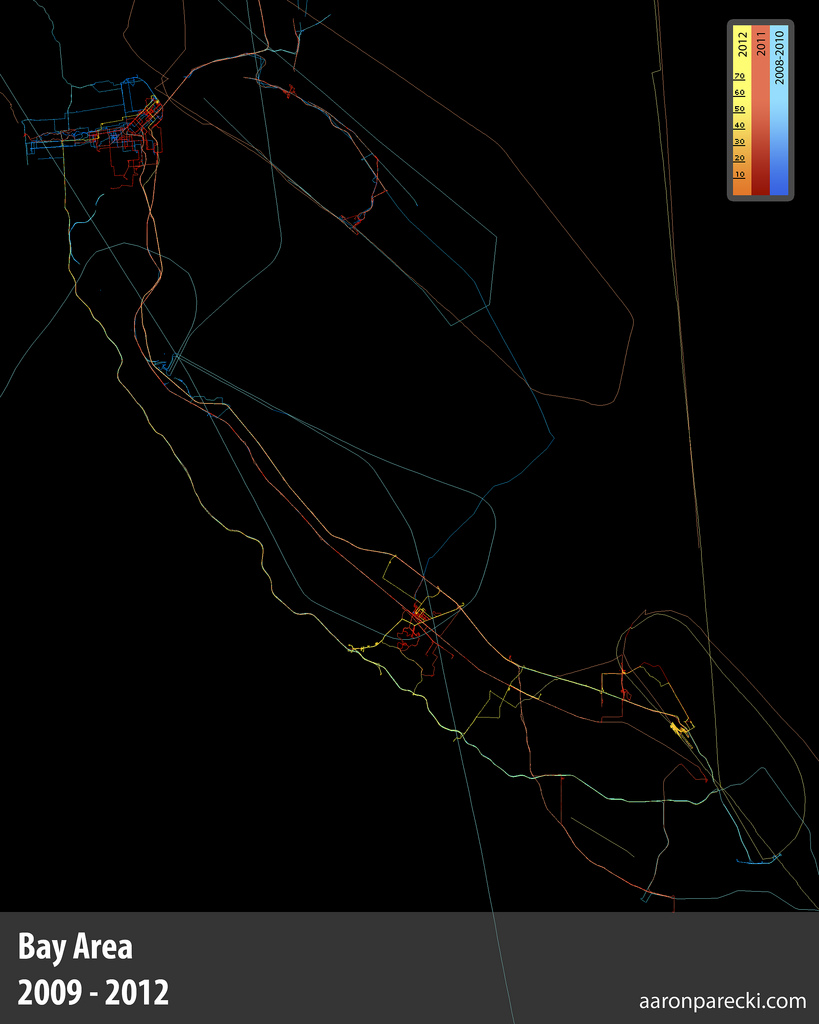
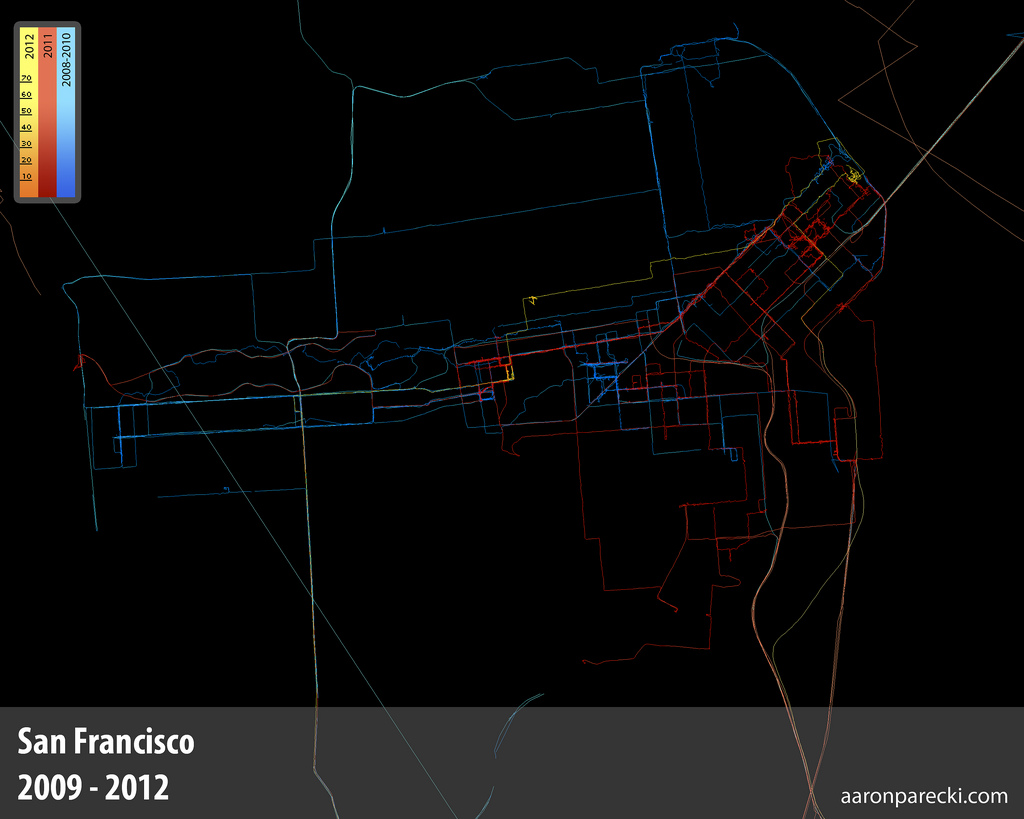
These are images of map generated entirely from GPS logs gathered by various versions of the Geoloqi sample application for iPhone and Android for the past 3.5 years. Once gathered, the data was run through a custom script that projects the GPS logs onto a 2D image plane. There is a little bit of logic to smooth out the lines and remove some (but not all) GPS noise.

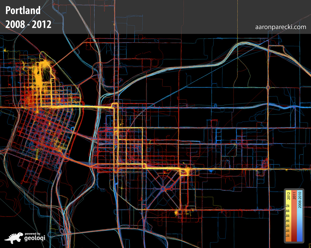
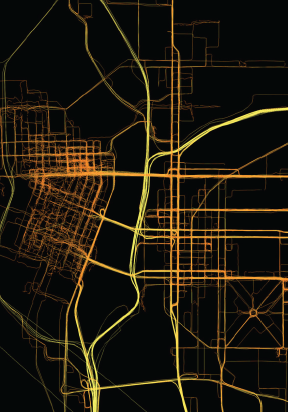
Aaron Parecki's GPS Map of Everywhere he's been in Portland since 2008

How Many Data Points?

Approximately one GPS point was recorded every 2-6 seconds when I was moving, and these images represent about 2.5 million total GPS points. Collectively, they represent a data portrait of my life: everywhere I’ve been and the places I’ve been most frequently. The map is colored by year, so you can see how my footprint changes over the years, depending on where I live.

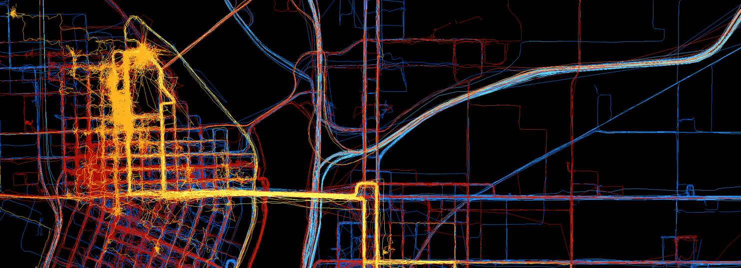
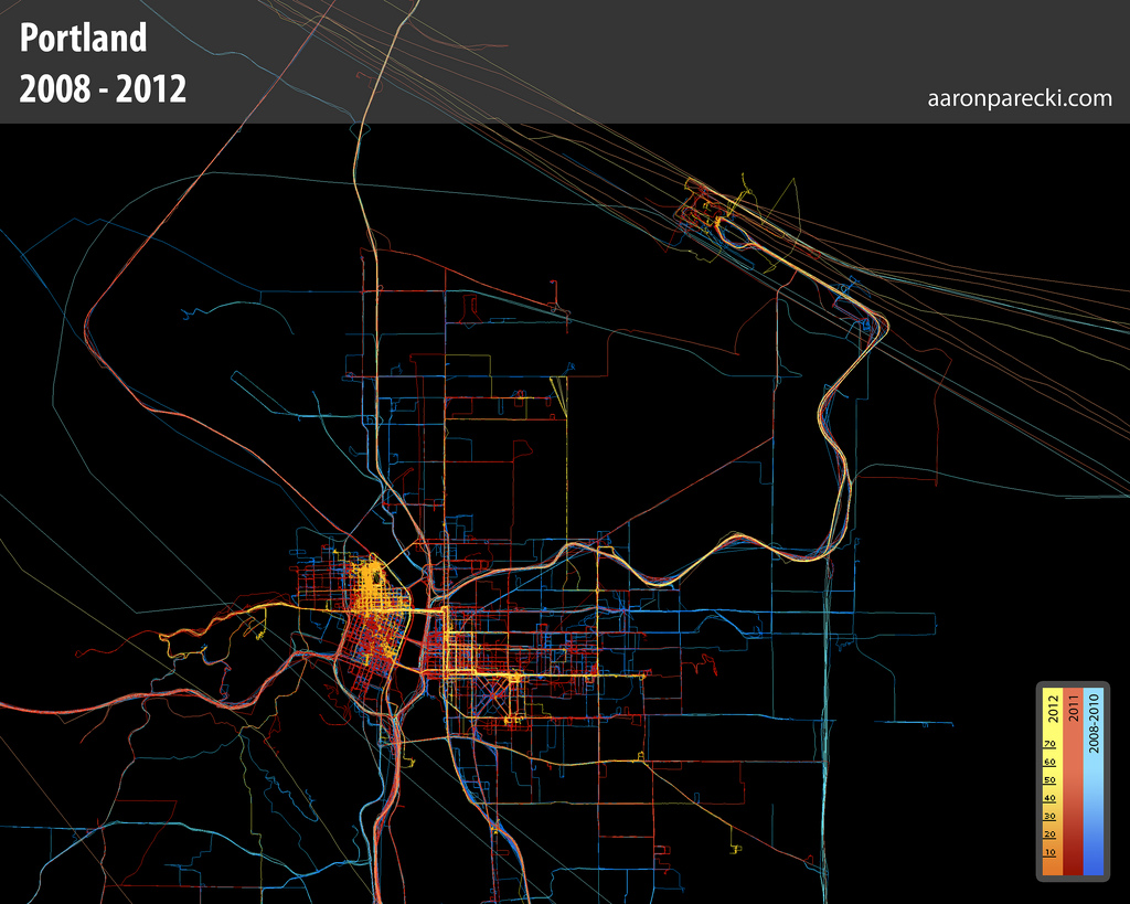
Aaron Parecki's GPS Logs since 2008.This is a map of everywhere I’ve been in Portland from 2008 to March 2012.

The long diagonal lines are airplane flights in and out of PDX. Some of the flights loop over the city when they take off.

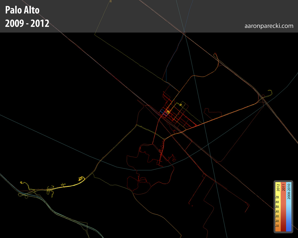
Aaron Parecki's GPS Logs from Palo Alto - 2009-2012

Aaron Parecki's GPS Logs from the Bay Area - 2008-2012

Aaron Parecki's GPS map from San Francisco - 2009-2012

Methods

To get data at this resolution, I had to bring back-up batteries with me and charge my phone whenever I could. I would manually turn the tracker on when I moved, and turn it off when I was at an indoor location for a long period of time. To get this level of accuracy results in a great deal of battery drain.

One of the reasons why I started Geoloqi is to be able to make tracking this kind of data easier for myself, and to improve battery life (along the way we took some of my manual methods for battery management and bundled it up into a set of mobile SDKs for iPhone and Android for adding location to applications without the intensive battery drain).

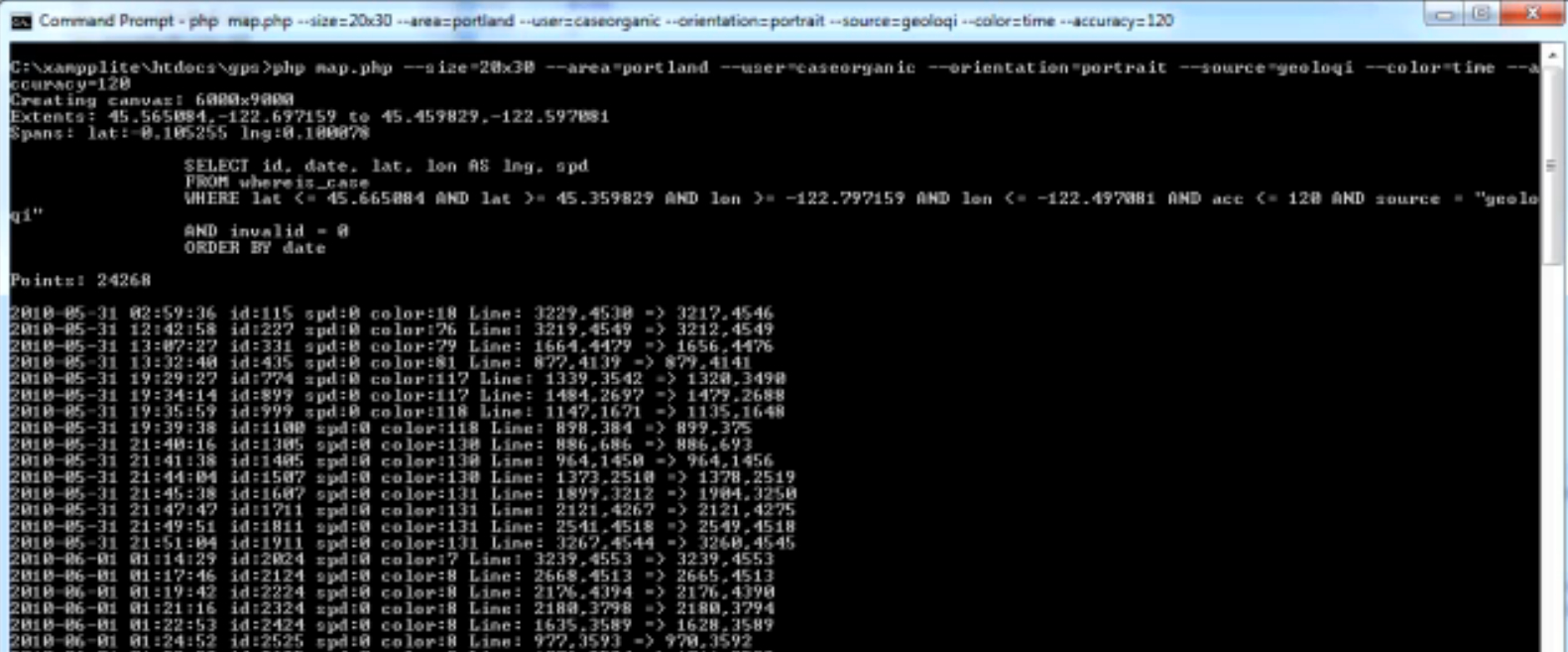
Below is an image of the script while it is running to produce the GPS maps. You can see a video of it processing a couple million GPS points here.

Command Line Prompt for Entering GPS Data

Use in Media

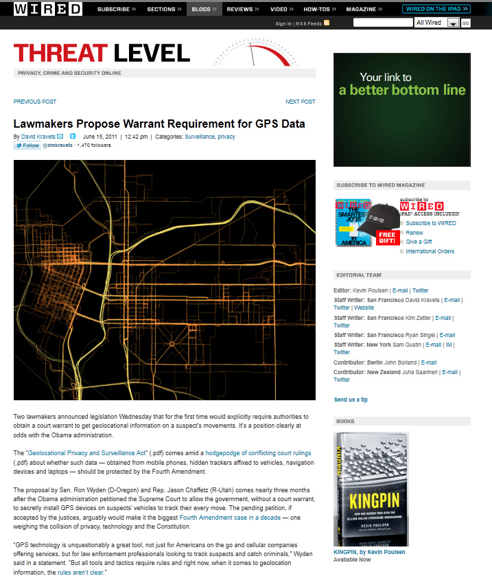
Some of the earlier images of the GPS maps started appearing in Wired online starting last year.

Wired - Threat Level Blog - GPS Tracking

History

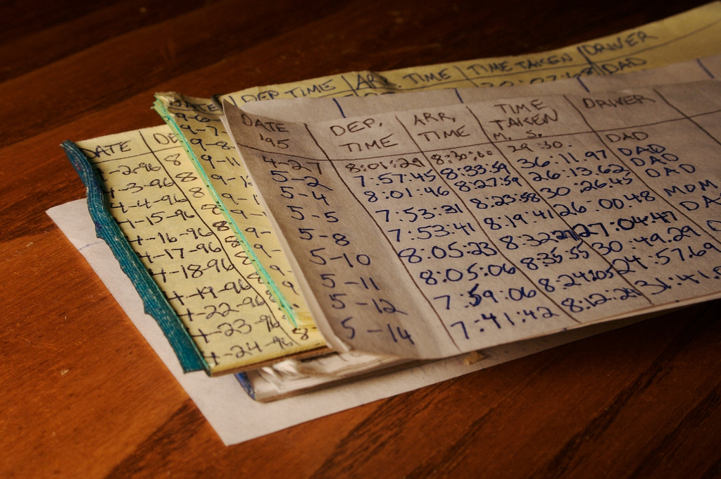
My fascination with GPS and data logging began at a relatively early age (around 10-12 years old, from 4th-6th grade). I recently found my stack of notepads from 3/29/1995 through 6/9/1997 where I logged my commute to school. I have mostly complete logs for the entire date range, including start time, end time, time traveled, who drove, and in what car. In addition, I used to take a highlighter

Analog Commute Logs - 1995-1997

Why do This?

I’ve always found it interesting to take raw data and make it visible. Before GPS chips were available in smartphones, it was very difficult to get high resolution data like this. Ubiquitous provides a way to see over time what was formerly invisible data. It allows one to see over time. In each of these cases, I’ve been able to process the raw data to answer personal questions like “what time is best to leave the house in the morning for work?”. Best of all, it is private data that I own and can do with what I like.

More Images

If you’d like to see all of the images I’ve recorded over the past 3.5 years, there’s a GPS Logs set on Flickr here.

About

This article was written by Aaron Parecki, Co-Founder of Geoloqi, a powerful platform for real-time location. You can follow him on Twitter @aaronpk.

Posted

Thu Sep 23 2010, 12:12pm

By Aaron Parecki

Categories

Events

Tagged

Geosketching – Cyborgs are Mapping Portland

The Grassy Knoll Gallery presents:

Geosketching – Gallery Show and CyborgCamp Pre-Party

Grassy Knoll Gallery
123 NW 2nd Ave
Portland, Oregon 97209
Friday, Oct 1st, 2010 6-9 PM

Exhibition Dates // Oct 1 – 29
Artist Reception // Friday, Oct 1st, 2010 6-9 PM. Free and open to the public
Gallery Hours // by appointment
DJ set by Let’s Go Outside

Where a person goes can reveal a lot about who they are and how they live. Thousands of people can live in the same city and have drastically different experiences.

GPS maps are a kind of technogeographical self portrait; a way of showing how one has lived during a certain period of time. The methods for taking data can reveal something about a person as well. There is no standard way of taking GPS data. One’s map may differ greatly from another. For the past two years, Aaron Parecki has been carrying a GPS tracker with him at all times, walking, busing, biking, driving and flying. Amber Case has been taking data since January 2010. Together, they have logged over 10 million GPS points. These points have been plotted onto paper, then color-coded by time of day and speed of movement to render beautiful and thought provoking prints that serve as “geotechnological” self-portraits.

Portland-based PHP developer and GPS enthusiast Aaron Parecki experiments with automatic location check-ins and proximal notification systems. He also began using GPS to control the lights in his house and perform other automated actions.

Amber Case is a Cyborg Anthropologist from Portland, Oregon. She studies the interaction between humans and computers and how our relationship with information is changing the way cultures think, act, and understand their worlds.

Together the two founded Geoloqi.com in an effort to make GPS tracking and advanced co-location protocols available to the general public.

How Can I Do This?

Geoloqi, a GPS tracker app for iPhone, Android, Blackberry and Palm is in constant development. It will allow anyone to take data and make maps like these. If you’d like to beta test or help us develop it, sign up at Geoloqi.com or follow @geoloqi on Twitter.

Geosketching will also be an opening celebration for the upcoming Cyborg Camp Portland 2010 on October 2nd.

About Cyborg Camp

CyborgCamp is an unconference about the future of the relationship between humans and technology. Topics discussed include, but are not limited to, social media, design, code, inventions, web 2.0, twitter, the future of communication, cyborg technology, anthropology, psychology, and philosophy.
For more information and to register go to portland.cyborgcamp.com or contact Amber Case.

Fashionbuddha Studio creates world-class animations and interactive experiences. Fashionbuddha Studio is featured in Communication Arts Design and Interactive Annual, how Magazine, and Best of Show at the 2009 Webvisionary Awards. www.fashionbuddha.com

About the Grassy Knoll Gallery

The Grassy Knoll Gallery began in August 2007 as a venture between Robert Lewis, owner of Fashionbuddha Animation Studio, and curator Renee Marcotte. Located on the second floor of the historic Merchant Hotel in Old Town, Grassy Knoll Gallery provides a unique outlet for illustrators and animators.

For more information on past, current and future shows or to purchase artwork online, please visit our website at www.grassyknollgallery.com.