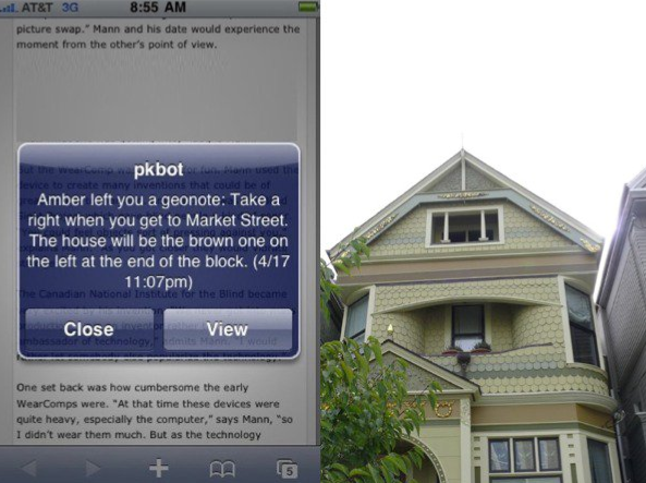
A Geonote is a location-based note that may be left for a user, and will send a message to the desired user only when that location is reached. Geonotes are based on the concept of “geofencing,” which involves detecting whether a GPS enabled mobile device has entered or exited a geographical radius. In the case of Geonotes, one can literally draw a circle anywhere on the planet, and if a GPS enabled device enters that radius, an SMS message will be sent to that device.
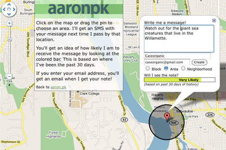
Try it!
Send us a Geonote: http://aaron.pk/geonote | http://caseorganic.com/geonote
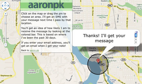
Instead of showing site visitors where we are, the website uses the last 30 days of GPS data to determine whether or not we will be “likely” to pick up the Geonote, or rather, the likelihood of us traveling through the circumference of the Geonote that has been left. GPS-enabled phones can do other things too. For instance, there’s a Geonote GPS circle above our house that triggers an X-10 light system to turn on or off depending on whether we enter or leave the circle. The lightswitch evaporates and we no longer have to press it. The GPS enabled phone becomes a remote control for reality.
 Geoloqi started because a lot of our friends wanted Geonotes but had no way of tracking GPS data on their phones. We began an open source project in our free time, and a number of volunteers began contributing code. Now we have a beta version of our GPS tracker running on iPhone and Android devices, and we no longer have to use older phone models to track GPS data.
Uses for Geonotes:
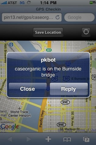
For instance, 2 weeks ago I remembered that I needed to get some paprika next time I went to the store. I wasn’t near a shopping list, and I knew it would be lost if I wrote it down on a piece of paper. So, as I said in my tweet, I left a Geonote with a circumference that surrounded my local grocery store. When I next went to the grocery store, my phone detected that I had entered the radius I’d left the Geonote in before. I promptly received an SMS with the note to “Get Paprika!”. Needless to say, I got it.
When we first started sending out the Geonote link, my friend Don Park sent me some useful and entertaining Geonotes. He left one for me over the Hawthorne bridge in Portland, Oregon. When I crossed the bridge, I got a note that told me that the bridge was built in 1910 and that 4,800 cyclists crossed it daily. Suddenly, Geonotes allowed geography to become trivia. When I was on a hike on nearby Mt. Tabor, I received a Geonote from Don that told me that wild Blackberries were nearby, and that I should pick some.
Trip Planning:
On a recent trip to San Fransisco for a conference, I set a series of Geonotes to greet me when I arrived at the airport. When I got off the plane, I got a note welcoming me to San Francisco. Then I got a note telling me which bus to take into town. When I got on the bus I didn’t have to worry when to get off, because I had set a Geonote that told me to get off the bus. When I got off the bus, the next Geonote told me the address of my friend’s house.
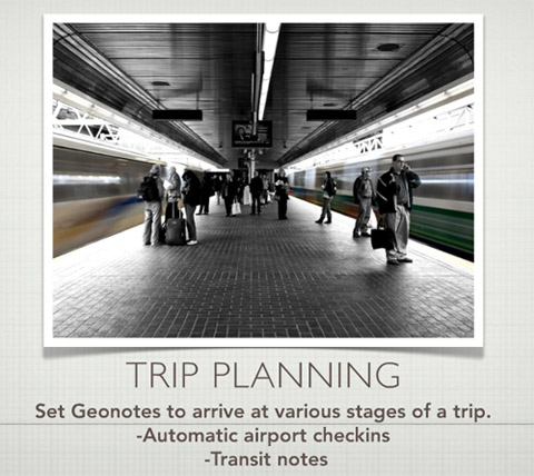
The difference between a normal travel experience and one traveling with Geonotes was that it saved me from looking down at my phone all the time to query my E-mail account for an address, bus stop or transit direction. The Geonotes allowed me to sit back and relax and live my life instead of pulling information out of a mobile device. Instead of pulling, the device pushed just in time information to me at the relevant points of my travel. These virtual post-it notes have been fun to experiment with.
About Geonotes and Geoloqi:
Geonotes are part of Geoloqi – a secure, open source platform and standard for location sharing developed by an open source developer community. When Geoloqi is released, everyone will be able to have their own Geonotes. There’s a longer slideshow about how it works here: http://www.slideshare.net/caseorganic/nonvisual-augmented-reality-with-sms-and-gps-open-source-bridge
You can leave a Geonote for Aaron and I here: http://aaron.pk/geonote http://caseorganic.com/geonote
