Posts Tagged ‘geonotes’

Introducing Geonotes for iPhone and Android!

The Geonotes App is here for iPhone and Android!

Today we’re annouching something big! An update to the Geoloqi app. This demo app is the update to the app we released over a year ago. Since then, we’ve released geofencing and real-time SDKs for iPhone and Android.

Time for an Update!
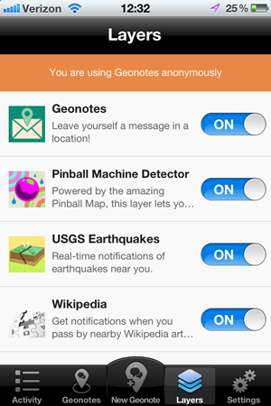
Geoloqi's Geonotes for iPhone
It’s sometimes hard for us to find time to work on apps directly, because our focus is on building a great geofencing platform for mobile development, which is a lot of work.

We wanted to revamp our Geoloqi demo app to take advantage of the battery and accuracy improvements in the SDK, and also provide a way to have people subscribe to the free geo layers that we like to make in our spare time.

Last month, we finally got a chance to sit down and re-write our demo app to use the new SDK, and the result is here: the new Geonotes app from Geoloqi!

With the Geonotes app, you can finally provide battery-safe location context to your daily life: Instead of having to pull out your phone and slowly dig up information every time you need it, your phone becomes your sidekick. When you are in a certain location, it will provide information that is only useful to you when you are in that location.

Get it now for iPhone and Android!

Geonotes is available now for download in the App Store and Android Market. Download it now, add some geonotes, subscribe to layers, and see how fun it is to have location-based knowledge work for you!

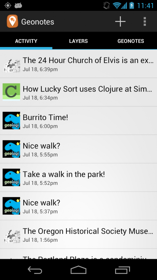
Activity Stream

Now all of your geonotes and layer notifications show up in a stream on the app!

Geonotes: Location-based Reminders

For example, when I went shopping, I would always forget to buy bananas, and then regret it when I didn’t have any for breakfast the next day. So with the Geonotes app, I have created a reminder for myself that reminds me to buy bananas when I’m shopping, so I don’t forget.

Layers: Location-based Content

You can also subscribe to Layers, which are plugins to the Geonotes app that provide information for you based on your location. For example, the Wikipedia layer will provide links to articles and a brief description when you walk by places that have Wikipedia pages. I turn it on when I’m visiting new cities, because it’s a great way to get a tour of the city just by walking around.

There are many other layers, including one that notifies you when there was a nearby earthquake. And the Pinball Map layer, which will let you know when you’ve walked near a place that has pinball machines!

And because it’s powered by the Geoloqi Platform API, developers can program with this content to their hearts content. Using Geoloqi’s developer tools, you can make your own layers to add interesting geo-location content. For example, instead of leaving a Geonote to remind me to get bananas, I could program it to provide a shopping list when I’m at the store.

If you make any interesting layers, let us know! We’ll add it to our global list of layers.

Real-Time Tracking

Genotes only does ambient background tracking. To enable real-time tracking, use our GeoTracks app, available for Android (and iPhone, shortly).

Want these features in your apps?

Check out the Geoloqi Platform. With SDKs for iPhone and Android, you’ve got the majority of the market covered. Or if you want to develop for both devices at once, try the Geoloqi module for Appcelerator’s Titanium platform!
Download Geonotes!

Geoloqi’s Geonotes for iPhone

Geonotes for Android on Google Play

Geoloqi for iPhone now in the app store!

After nearly a year of planning, testing and development Geoloqi for iPhone is now in the app store!

This is the first version. Many more features will be added over time. Thanks to everyone who helped build, test, design and suggest features! There will be more to come, including more layers, a layer builder, advanced Geonotes and more in upcoming releases.

You can download Geoloqi for iPhone here.

Geoloqi in the app store!

What is Geoloqi?

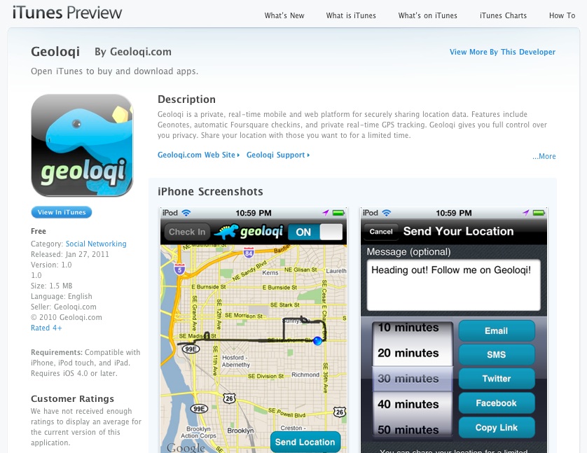
Geoloqi is a private, real-time mobile and web platform for securely sharing location data. Features include Geonotes, automatic Foursquare checkins, and private real-time GPS tracking. Geoloqi gives you full control over you privacy. Share your location with those you want to for a limited time.

The GPS tracker runs in the background, and has full tracking settings. Choose from high resolution tracking, battery saver mode or your own custom settings. Worried about battery consumption? You’ll get a warning when your battery gets too low.

Geoloqi for iPhone

Features in this release:

  • Automatic Foursquare Checkins for your favorite places
  • Send Geonotes from the phone or website.
  • Location sharing
  • Facebook integration (share your location easily on Facebook)
  • History – see your location history on the website!
  • Anonymous tracking – want the ultimate privacy? Track and send your location anonymously!
  • USGS Earthquake layer – get notified of earthquakes within 250km of your location

Uses

* Share your location by Email, SMS, Twitter and Facebook, or copy the URL and paste it anywhere.
* Set a time for the link to expire and choose who to share it with. The system is completely private and easy to use.
* Your friends don’t have to have Geoloqi on their phones to receive your location updates! * Simply send your location sharing link to them and they can view your real-time location updates on a mobile friendly browser, allowing you to send your location to anyone with a smartphone!
* When your location expires, people won’t be able to access it, keeping where you are private!

Geonotes – Send a message to your future self!

* The Geonote option allows you to leave a message in a location and have it Emailed, texted or pushed to you when you get to that location.
* Send yourself a Geonote at the store so that you remember what groceries to get, or leave yourself a note at work reminding yourself of an important task.

Use Cases

  • Track your location as you run, or allow your spouse or loved ones to see your trail.
  • Biking or motorcycling? Visualize the entire trip! As you track yourself, you’ll be able to see a trail of where you’ve been over time.
  • Relax and automatically check yourself into your favorite locations as you go about your day! Use the layer feature to subscribe to geocoded data in real-time!
  • Build your own layer using the Geoloqi API! iPhone app works with Geoloqi’s website, allowing you to share location and send Geonotes from the web.

Future features

  • Inbox for Geonotes — don’t like getting Geonotes by Email? Miss a push notification? Geonotes will have their own home inside the app.
  • Semi-automatic Foursquare checkings — choose from a list of places and easily check in when you get to a place.
  • See friends on Twitter who use Geoloqi and leave them geonotes.
  • Better mobile map and sharing!
  • Layer creation tool. Build your own layers!
  • See your friends as layers
  • Android app

Press

Read more about Geoloqi on Forbes, CNN, JWT’s 100 Things to Watch in 2011 and ReadWriteWeb.

Posted

Tue Jan 4 2011, 5:17pm

By caseorganic

Categories

Tutorials

Tagged

How to Use Geoloqi with an Android Phone

Note: Geoloqi no longer works with Instamapper

Note: This tutorial used InstaMapper, a free GPS tracking and location sharing service. After nearly 5 years of operation, the site shut down on December 13th, 2012. There are now dedicated Geoloqi apps for Android. You can now download Geonotes or Geotracks for Android.

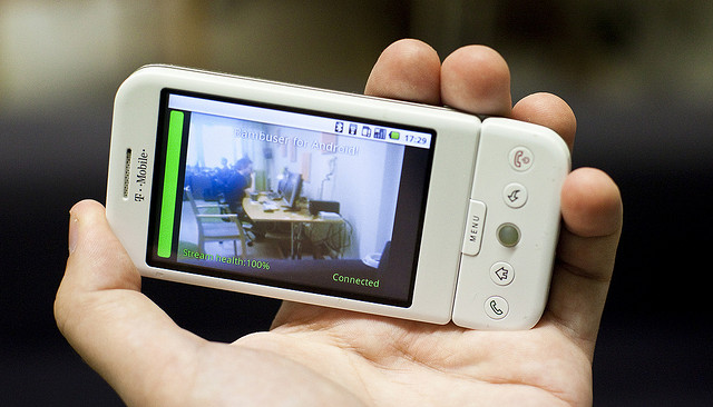
Flickr photo by tomsun

If you have an Android or Blackberry, you can use Geoloqi right now. Currently, the Geoloqi app is in beta testing. The first Geoloqi app release is for iPhones running 4.0 or later, however, Geoloqi has Instamapper integration, which means that you can use Geoloqi, including sending yourself Geonotes, if you have a Blackberry or Android. The only difference is that you’ll have to use the Geoloqi.com website to leave yourself Geonotes – only the iPhone version will allow you to do it from the phone.

1. Log into http://beta.geoloqi.com and enter your phone number in the field provided. Then go to http://beta.geoloqi.com/settings/connections.

Under “Geolocation Services” you’ll see “Instamapper Device Key”. Click the “Create” button. A Device Key will appear shortly afterward.

2. Go to the Android store on your phone and find a free app called GPS Tracker by Instamapper.

Download the app and start running it. Click on “Menu” and click on “Settings”. You’ll see a field to enter your device key that you generated on Geoloqi. Enter that key there.

The rest of the settings concern what interval you’d like the GPS tracker to track at. Setting the tracker to track every 5 seconds will wear down your battery more quickly, but it will give you a very high resolution trail to look at on your map on Geoloqi.com. Set the buffer size at 100, and don’t worry about the Units. Imperial is fine. Setting Minimum accuracy (ft) to 1000 is also recommended. This way, Geoloqi will ignore points that are less accurate than 1000ft.

General Functions:
Press the “Menu” key to bring up settings.
Press the “Home” key to run GPS Tracker in the background.
Press the “Back” key to quit tracking.

A note on battery life:
GPS is powered on continuously for send intervals less than 121 seconds. If you want better battery life, set the send interval to at least 121 seconds. This will cause GPS Tracker to go to sleep in-between updates.

From there on out, you can use all the features of Geoloqi available on the website. Click on your map to see your history, share a link with others, and send yourself a Geonote by drawing a radius on the map, writing a message, and clicking send. If you share your location with someone, they’ll get a mobile version of your trail on their mobile phone, and a web version of your trail on the web.

You can toggle your privacy options at http://beta.geoloqi.com/settings/privacy and see your list of shared links at http://beta.geoloqi.com/settings/share. All of your account settings are at http://beta.geoloqi.com/settings/profile.

Finally,if you want to quickly access your map, you can easily do so by going to http://beta.geoloqi.com/username or where the username is the id of the Twitter account you used to sign in. If you didn’t sign in with Twitter, go to the connections tab in Geoloqi to connect your Twitter account. You’ll then be able to easily access your Geoloqi account by username URL.

Additional Help
If you have more questions, see Geoloqi Help. If you can’t find what you need there, please ask a question! We’ll get to it as quickly as we can.

Flickr photo by tomsun.

How to Use Geoloqi with a Blackberry Phone

Note: Instamapper no longer supports Blackberry. This tutorial is now expired.

Blackberry photo by Mr. T in DC on Flickr

If you have a Blackberry, you can use Geoloqi right now. Currently, the Geoloqi app is in beta testing. The first Geoloqi app release is for iPhones running 4.0 or later, however, Geoloqi has Instamapper integration, which means that you can use Geoloqi, including sending yourself Geonotes, if you have a Blackberry or Android. The only difference is that you’ll have to use the Geoloqi.com website to leave yourself Geonotes – only the iPhone version will allow you to do it from the phone.

1. Log into http://beta.geoloqi.com and enter your phone number in the field provided. Then go to http://beta.geoloqi.com/settings/connections. Under “Geolocation Services” you’ll see “Instamapper Device Key”. Click the “Create” button. A Device Key will appear shortly afterward.

2. Install the “GPS Tracker” application from BlackBerry App World or download it over the air: http://www.instamapper.com/download/GPSTrackerBB.jad
For BlackBerry Storm, you can also try this binary with a higher resolution icon: http://www.instamapper.com/download/GPSTrackerStorm.jad

3. Start the application (look for an icon that looks like a satellite) and enter the 13-digit device key you got from the Geoloqi website.

Usage Notes:

  • Press the red hangup key to run GPS Tracker in the background.
  • Press the “Escape” key to quit tracking.
  • To have GPS Tracker start automatically when the phone boots, check “Auto-start on boot” in settings.

During the first few days of operation, the application will periodically pop into foreground. This is done to minimize the possibility that someone would use our service to track another person covertly (which is against our terms of service). Press the red hangup key to hide the application when it surfaces.

Notes on Support
All recent BlackBerries (OS version 4.2.1 and later) are supported. In particular, almost any BlackBerry bought from AT&T and Sprint should work out of the box. Note, however, that many BlackBerries do not have built-in GPS and need an external GPS receiver. Additionaly, some carriers (most notably Verizon) disable GPS access on their BlackBerries. If you have a Verizon phone, it will most likely not work. Corporate phones may also restrict access to network and/or GPS.

Enjoy using Geoloqi! If you run into any problems, or would like more information on how Geoloqi works, see Geoloqi Help. If you don’t find what you’re looking for, feel free to ask a question! We’ll be there to answer it.

Flickr photo credit: Mr. T in DC.

Posted

Sat Aug 28 2010, 1:13pm

By caseorganic

Categories

Features

Tagged

Geonotes – Send Messages to Your Future Self

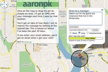
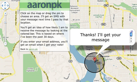
A Geonote is a location-based note that may be left for a user, and will send a message to the desired user only when that location is reached. Geonotes are based on the concept of “geofencing,” which involves detecting whether a GPS enabled mobile device has entered or exited a geographical radius. In the case of Geonotes, one can literally draw a circle anywhere on the planet, and if a GPS enabled device enters that radius, an SMS message will be sent to that device.

Try it!

Send us a Geonote: http://aaron.pk/geonote | http://caseorganic.com/geonote

Instead of showing site visitors where we are, the website uses the last 30 days of GPS data to determine whether or not we will be “likely” to pick up the Geonote, or rather, the likelihood of us traveling through the circumference of the Geonote that has been left. GPS-enabled phones can do other things too. For instance, there’s a Geonote GPS circle above our house that triggers an X-10 light system to turn on or off depending on whether we enter or leave the circle. The lightswitch evaporates and we no longer have to press it. The GPS enabled phone becomes a remote control for reality.

Geoloqi started because a lot of our friends wanted Geonotes but had no way of tracking GPS data on their phones. We began an open source project in our free time, and a number of volunteers began contributing code. Now we have a beta version of our GPS tracker running on iPhone and Android devices, and we no longer have to use older phone models to track GPS data.
Uses for Geonotes:

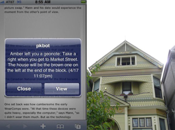
For instance, 2 weeks ago I remembered that I needed to get some paprika next time I went to the store. I wasn’t near a shopping list, and I knew it would be lost if I wrote it down on a piece of paper. So, as I said in my tweet, I left a Geonote with a circumference that surrounded my local grocery store. When I next went to the grocery store, my phone detected that I had entered the radius I’d left the Geonote in before. I promptly received an SMS with the note to “Get Paprika!”. Needless to say, I got it.

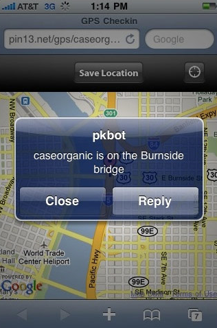
When we first started sending out the Geonote link, my friend Don Park sent me some useful and entertaining Geonotes. He left one for me over the Hawthorne bridge in Portland, Oregon. When I crossed the bridge, I got a note that told me that the bridge was built in 1910 and that 4,800 cyclists crossed it daily. Suddenly, Geonotes allowed geography to become trivia. When I was on a hike on nearby Mt. Tabor, I received a Geonote from Don that told me that wild Blackberries were nearby, and that I should pick some.

Trip Planning:

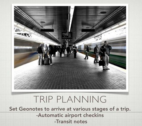
On a recent trip to San Fransisco for a conference, I set a series of Geonotes to greet me when I arrived at the airport. When I got off the plane, I got a note welcoming me to San Francisco. Then I got a note telling me which bus to take into town. When I got on the bus I didn’t have to worry when to get off, because I had set a Geonote that told me to get off the bus. When I got off the bus, the next Geonote told me the address of my friend’s house.

The difference between a normal travel experience and one traveling with Geonotes was that it saved me from looking down at my phone all the time to query my E-mail account for an address, bus stop or transit direction. The Geonotes allowed me to sit back and relax and live my life instead of pulling information out of a mobile device. Instead of pulling, the device pushed just in time information to me at the relevant points of my travel. These virtual post-it notes have been fun to experiment with.

About Geonotes and Geoloqi:

Geonotes are part of Geoloqi – a secure, open source platform and standard for location sharing developed by an open source developer community. When Geoloqi is released, everyone will be able to have their own Geonotes. There’s a longer slideshow about how it works here: http://www.slideshare.net/caseorganic/nonvisual-augmented-reality-with-sms-and-gps-open-source-bridge

You can leave a Geonote for Aaron and I here: http://aaron.pk/geonote http://caseorganic.com/geonote