Posted

Mon Sep 12 2011, 8:20pm

By caseorganic

Categories

Events

Tagged

Overview of this Sunday’s MapAttack Game in Ladd’s Addition!
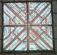

Last Sunday we invited 12 people participate in a game of MapAttack. We hosted the gamemap in the curiously-shaped SE Portland neighborhood called Ladd’s Addition. Created in 1891, it is one of Portland’s oldest planned residential districts. The neighborhood is known for its diagonal street pattern, which made it the perfect place to set up a test game.

What is MapAttack?

MapAttack is a game of real-time strategy built for real life. Virtual geofences are scattered onto the map and players must physically go to where they are on the map in order to capture them. The winner is the team that captures the most points. We built the game on the Geoloqi platform.
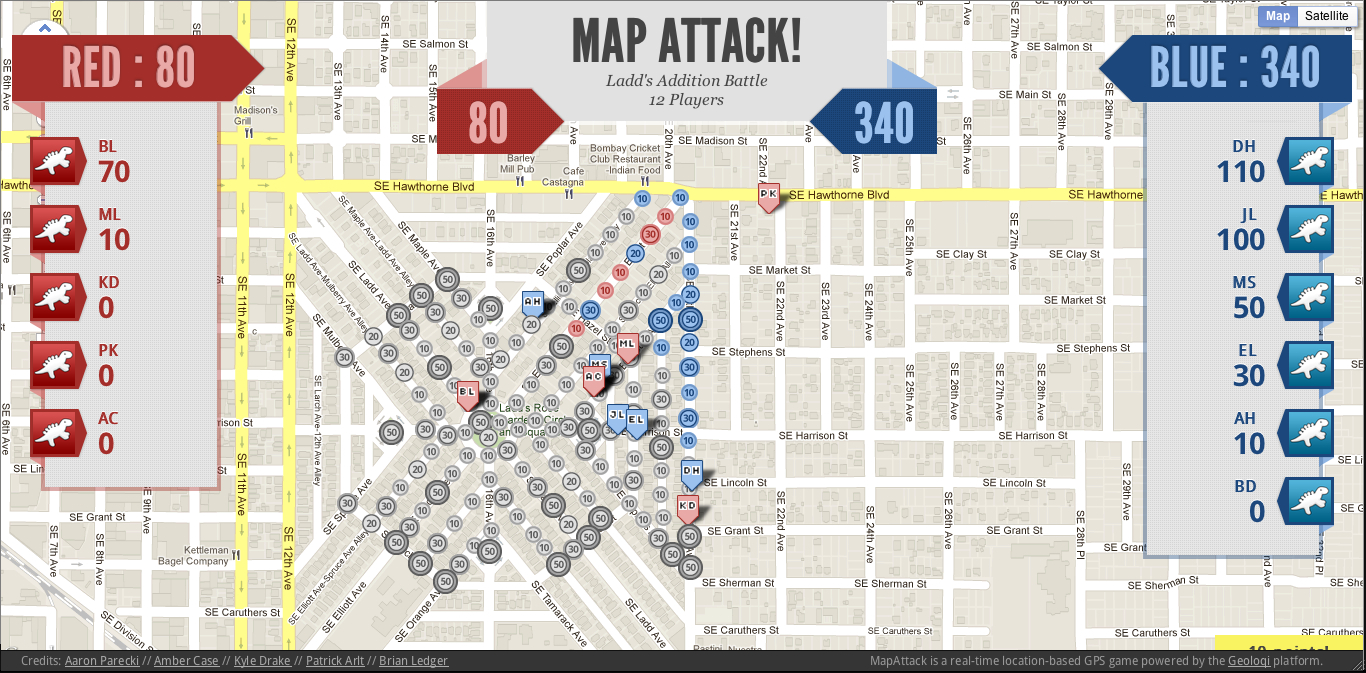
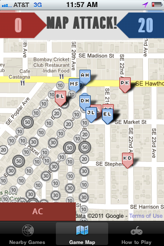
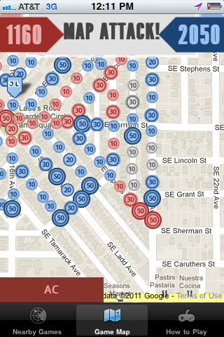
MapAttack Mid-Game

MapAttack - In-game iPhone ViewLate game MapAttack Mobile View

The idea behind MapAttack! is to be able to play in real life and to feel like a kid again. Suddenly everyday life becomes brighter and more intense, and you don’t care that you’ve just run 5 blocks because there’s a point up ahead that you have to catch before the guy on the other team does!

The twelve players got a custom build of the MapAttack! game on their phones, were automatically assigned to red and blue teams and huddled together to plan their strategy for picking up the dots.

The blue team started out with DH and AH in the lead running at full speed town the diagonals of Ladd’s Addition. As the other players joined in, everyone could see each other running in real-time on the map on the maps on their phones. The game became a sort of Marauder’s map where you could plot your next attack based on who was heading towards each point.

After about 20 minutes, the players on the map began to slow down, and we joined up with each other to walk back to the starting point. Some of the players were still running at full speed trying to get the rest of the points. Some were tired and met up to watch the game in progress on their phones. Aaron Parecki, the game moderator, sent some messages to us throughout the game egging us on. “Is the Blue team going to let the Red team capture those points near Lincoln Street?” read one of the push notifications. Almost immediately, we saw members of the Blue team rush over to try to capture those points.

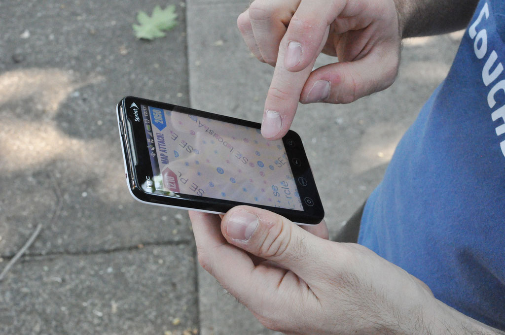
MapAttack! for Android

Gameplay and Strategy

Each player had a different plan of action for capturing the points on the gameboard. Some ran at top speed, trying to get to the highest value points on the board. Others strategically chose routes with the highest point values and gathered points that way.

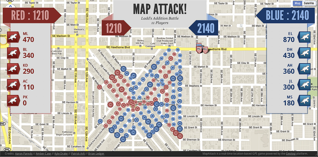
MapAttack End Game!

In the end, we were all exhausted. Most of us hadn’t run that fast since we were kids. Many of the players had never played a real-life mobile game before, and MapAttack is the first of its kind.

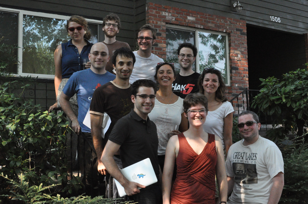
MapAttack Players on Sunday!

The twelve people that played the game had a great and exhausting time. We ate a bunch of fresh fruit and relaxed afterwards. It was a great game for a hot summer day.

Geoloqi Technology

We built MapAttack on the Geoloqi platform in order to test the platform’s real-time location and our new ability to rapidly detect which phones were in small, accurate geofences. This was the first test of the game in a real-time server environment. That meant that everything on the phones and on the web moved as if they were moving in real life. The new code actually allowed the phones to update their location in real-time to the map with a minimal drain on battery. This was the first time we put it all together for a seamless player experience.

Bring MapAttack to your city, school or company!

Want to bring a game to your school or company? Contact us at mapattack at geoloqi dot com and we’ll be glad to help you out! You can also follow @playmapattack on Twitter for the latest games and news! We’ll be bringing it to more campuses and cities starting in Sweden this week! You can also visit MapAttack on the web at http://mapattack.org/.
Posted

Wed Aug 31 2011, 2:14pm

By caseorganic

Categories

News

Tagged

Norway’s Hyper Interaktiv Uses Geoloqi for iPhone to Track Balloon Flight 17 km in the Air!

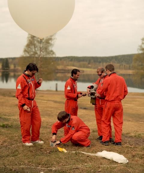
Hyper Interaktiv Team Preparing Balloon Launch

When we heard from Hyper Interaktiv’s Atle Mo (@atlemo) that he had tracked a balloon with Geoloqi and wanted to export the data to Google Earth, Geoloqi co-founder Aaron Parecki whipped a quick KML export feature for the team.

The team was able to track the Balloon’s flight from the ground on the Geoloqi website and were able to use the trail to find the after it came back down to Earth. They also generated a bunch of images of the balloon’s flight using the Geoloqi data.

The Hyper Interactive team launched a high-altitude balloon on August 25th from Oslo, Norway at the Hyper.no office. The balloon was launched in celebration of Hyper’s 10th anniversary. The balloon went up to 17 kilometers in the air before exploding and then floating down to Earth to land in a tree.

Tracking the Balloon with Geoloqi

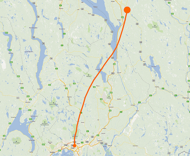
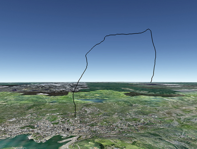
Balloon's Flight Path as Recorded by Geoloqi

The team used an iPhone 4 with Geoloqi to track the flight and a Hero GoPro HD camera to videotape the flight.

The highest altitude reached was 17,97 km and the travel distance was around 120 km. The team used the Geoloqi website to track the balloon once it touched down!

Google Earth View

Balloon's Flight Path in Google Earth
Atle Mo used Geoloqi’s KML export to view the flight data in Google Earth.

Video of the Flight:

Their video shows the full flight of the balloon. You can see it rise up to 17 km before slowly falling and landing in a tree.

Norwegian publication Dagbladet.no also covered the story if you’d like to learn more about the flight and the team! Also check out Hyper Interaktiv!

Posted

Mon Jul 18 2011, 3:15pm

By caseorganic

Categories

API
News

Geoloqi Developer Site is Live!

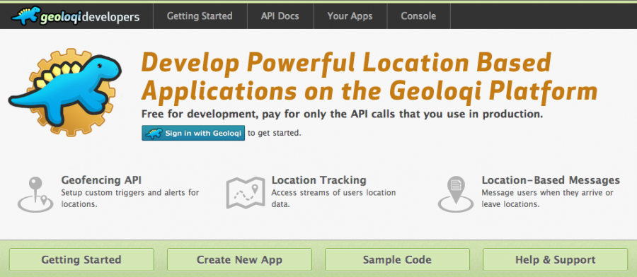
We just released a developer site for the Geoloqi API, allowing you to create powerful location-based applications on the Geoloqi Platform. The platform is free for development, and you pay for only the API calls that are used in production. If you’d like to use Geoloqi for larger purposes, feel free to contact us.

Geoloqi Developer Site

Why use the Geoloqi platform? It’s ideal for development teams and entrepreneurs who want to build real-time location sharing or geofencing features into new or existing applications. You can can use the Geoloqi platform to monitor user locations and send messages based on activity, build location-aware applications that work on top of popular APIs such as Foursquare, Twitter and Facebook, and send messages to users when they are near a location at a certain time of day, or are travelling at a certain speed.

The platform includes a Geofencing API, location tracking API and a location-based messaging system. Full documentation and an API console are available on the developer site at https://developers.geoloqi.com/

About Geoloqi

Geoloqi is a private, real-time mobile and web platform for securely sharing location data, with features such as alerts based on proximity, and sharing real-time GPS maps with friends. The platform enables users to share real-time location information, allowing them to communicate where they have been, where they are, and where they will be. The Geoloqi platform makes it easy for companies to build powerful location-based applications. Geoloqi closed $350,000 in seed investment to build a platform and applications for location-aware applications this July.

Posted

Mon May 16 2011, 10:10am

By caseorganic

Categories

News

Tagged

Geoloqi-powered flashmob game takes grand prize at Amped Hackathon in Seattle!

This weekend a Geoloqi-powered flashmob game won the Amped Hack Day competition in Seattle, Washington. The competition was put on as an appendix to Seattle’s WebDirections conference.


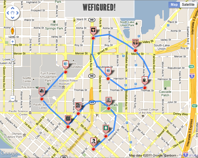
WeFigured is a RealTime geo location based team game with a twist on Social Rewards. Sponsors create patterns with spots that need to be filled. Once users fill the spots, they get rewarded!

Why Should you go figure?

Players

  • Make visiting places fun.
  • Discover new venues, bars, restaurants, museums and more.
  • Get Rewarded to go out.
  • Have a cause ? Create a custom pattern and get people to fill the spots

Sponsors

  • Get discovered
  • Promote your venue and event
  • Join the revolution – help people express themselves as patterns on the map
  • Offer exclusive deals

Each team member won a Bluetooth headset and a Motorola smartphone (useful for development). The entire app was built in a few hours, and the presentation included a live demo of the end of the game.

The app was built by Aaron Parecki, Gaurav Maken, Alex Kamotsky and Kirill Zubovsky. Zubovsky has a longer post on the hackathon experience here.

Posted

Fri May 6 2011, 5:17pm

By caseorganic

Categories

Press

Tagged

Gizmodo: Geoloqi Makes Constant Location Tracking Awesome Instead of Creepy

“Your iPhone knowing your every move without your knowledge and without function: bad thing. Your phone knowing your every move so that you can share it with friends, receive geotagged reminders, and keep track of travels: very, very cool”. -Sam Biddle

Today at about 3PM EST, Geoloqi was covered by Gizmodo. Our servers quickly fell under the resulting account signups and location data. We quickly worked to scale them up so that the service could be resumed. Thanks to everyone who downloaded the app! The version out now is very beta. We’re working to improve the user experience, battery life and features. If you have any suggestions, please contact us at feedback at geoloqi dot com!

What makes Geoloqi private?

Geoloqi is an “opt-in” app, meaning that it allows you full control over your location and who you share it with. We plan on rolling out many more features, which you will find in the layers section of the app. If you’d like to build your own Geoloqi layer, or an entire application based on the Geoloqi platform, you can check out the API.

Follow @geoloqi on Twitter for more!