Posts Tagged ‘background location’

Unleash the Next Generation of Location with Geoloqi for Titanium!

Geoloqi's Location Module for the Titanium Platform

My co-founder, Aaron Parecki, and I share a belief: Things happen in places. We all carry around incredibly powerful mobile phones in our pockets, and we spend all our time interacting with them and not with the world around us. We believe that location services should be an invisible trigger for actions that take place on the device or in the cloud.

Aaron and I set out to start a company that would help developers create calm applications that recede into the background and only present themselves to users when they have contextually relevant actions or information to share. Our hope is to get people to look up from their screens and go about their daily lives.

The reality is that building a location service within an application is complex and time-consuming.

The Old School Way

You have to figure out how the different mobile platforms handle location features, how you’ll enable push-messaging in these different environments, how to set up a system for storing the geodata, how to create a method for tracking and analyzing the data, and, most importantly, how to make your location app accurate without draining the phone’s battery.

We founded Geoloqi to hide all the complexity of developing a location service “under the hood”. Geoloqi has published a robust, next-generation, location-based platform that makes it easy for developers to add location context within their mobile apps.

Geoloqi to the Rescue!

One of the primary problems with location-tracking apps today is that they have a tendency to drain smartphones’ batteries by always running the GPS in the background, or constantly pinging cell towers. Titanium Geoloqi Module Geoloqi uses algorithms that know when to turn the GPS on and off, which preserves battery life. For example, if your app is using a geofence, it knows that the GPS doesn’t have to constantly be running unless the user is near that geofence.
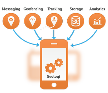
Another problem has been enabling individualized geotriggers. Unlike first-generation location services that use geofences as filters to determine which group of users to send a broadcast message to, our advanced platform allows your application to push messages and execute events to a single end-user at the moment they cross into a geofence, dwell within it, or depart the zone.

Use Cases
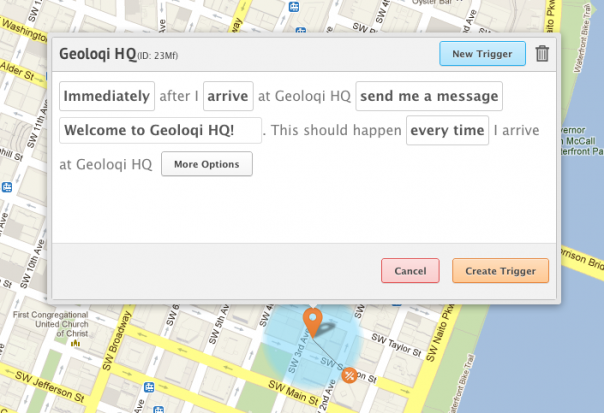
Geoloqi Visual Trigger Editor
The opportunities these geo-triggered events enables are limitless:

Retail

Imagine a large retail chain that is able to push their (opted in) loyal customers a message as they enter the store, not only welcoming them to the store by name and providing them with loyalty points for their visit, but also integrated into the chain’s CRM system to allow the app to mention that their favorite item is on sale that day.

Hospitality

Imagine a hotel chain that automatically recognizes that a patron has pulled into their parking lot, automatically checks the user into the hotel, and has their room key and paperwork waiting at the front desk by the time they walk in from the lot.

Deals and Rewards

Alert users to nearby deals by sending them a push notifications when they are within a few blocks of an offer! Use an existing database of offers or use the Geoloqi visual trigger editor to create custom ones. Or, use Geoloqi to give virtual currency for their favorite mobile game if they visit the a venue or store.

Tourism

Tourism boards can create location-based tours of historical information that will send messages to users about points of interest as they travel around a city or state.

Home Automation

Trigger a home automation system to turn the lights on when a person gets home, and automatically turn off when one leaves.

The Geoloqi Titanium Module

The Geoloqi Titanium module enables persistent/ambient background location tracking, intelligent battery management, and transitions smoothly between location sources such as carrier signals, GPS and Wifi for true real-time tracking. It also provides rich location and dwell-time analytics, giving your clients the ability to analyze and take action on location data.

At Geoloqi, we are excited to give you the tools to easily make location services that are present when your user needs them and invisible when they don’t.

Two free months of Geoloqi when you sign up today!

Thanks to Appcelerator’s sponsorship, if you download the Geoloqi Titanium module before June 30th you can try it for free for two months, and experience how Geoloqi takes care of the hard parts of geo for you.

Geoloqi/Titanium Webinar

Geoloqi CTO Aaron Parecki and Appcelerator CTO Nolan Wright will be doing a webinar at 11Am PST on May 29th, 2012. Check out Appcelerator for details or register for the Webinar directly. You can also follow @geoloqi on Twitter.
Posted

Tue Jan 4 2011, 5:17pm

By caseorganic

Categories

Tutorials

Tagged

How to Use Geoloqi with an Android Phone

Note: Geoloqi no longer works with Instamapper

Note: This tutorial used InstaMapper, a free GPS tracking and location sharing service. After nearly 5 years of operation, the site shut down on December 13th, 2012. There are now dedicated Geoloqi apps for Android. You can now download Geonotes or Geotracks for Android.

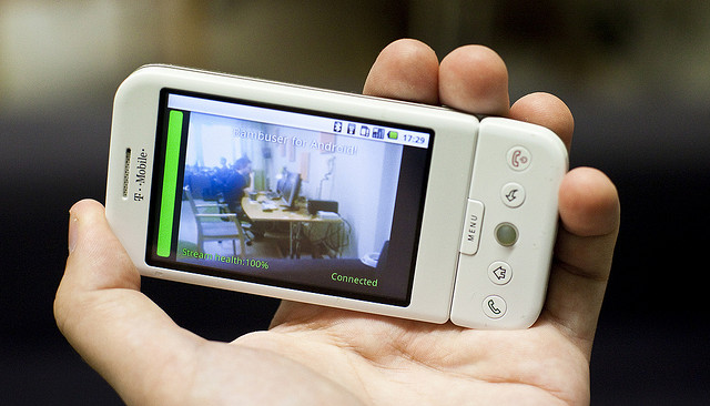
Flickr photo by tomsun

If you have an Android or Blackberry, you can use Geoloqi right now. Currently, the Geoloqi app is in beta testing. The first Geoloqi app release is for iPhones running 4.0 or later, however, Geoloqi has Instamapper integration, which means that you can use Geoloqi, including sending yourself Geonotes, if you have a Blackberry or Android. The only difference is that you’ll have to use the Geoloqi.com website to leave yourself Geonotes – only the iPhone version will allow you to do it from the phone.

1. Log into http://beta.geoloqi.com and enter your phone number in the field provided. Then go to http://beta.geoloqi.com/settings/connections.

Under “Geolocation Services” you’ll see “Instamapper Device Key”. Click the “Create” button. A Device Key will appear shortly afterward.

2. Go to the Android store on your phone and find a free app called GPS Tracker by Instamapper.

Download the app and start running it. Click on “Menu” and click on “Settings”. You’ll see a field to enter your device key that you generated on Geoloqi. Enter that key there.

The rest of the settings concern what interval you’d like the GPS tracker to track at. Setting the tracker to track every 5 seconds will wear down your battery more quickly, but it will give you a very high resolution trail to look at on your map on Geoloqi.com. Set the buffer size at 100, and don’t worry about the Units. Imperial is fine. Setting Minimum accuracy (ft) to 1000 is also recommended. This way, Geoloqi will ignore points that are less accurate than 1000ft.

General Functions:
Press the “Menu” key to bring up settings.
Press the “Home” key to run GPS Tracker in the background.
Press the “Back” key to quit tracking.

A note on battery life:
GPS is powered on continuously for send intervals less than 121 seconds. If you want better battery life, set the send interval to at least 121 seconds. This will cause GPS Tracker to go to sleep in-between updates.

From there on out, you can use all the features of Geoloqi available on the website. Click on your map to see your history, share a link with others, and send yourself a Geonote by drawing a radius on the map, writing a message, and clicking send. If you share your location with someone, they’ll get a mobile version of your trail on their mobile phone, and a web version of your trail on the web.

You can toggle your privacy options at http://beta.geoloqi.com/settings/privacy and see your list of shared links at http://beta.geoloqi.com/settings/share. All of your account settings are at http://beta.geoloqi.com/settings/profile.

Finally,if you want to quickly access your map, you can easily do so by going to http://beta.geoloqi.com/username or where the username is the id of the Twitter account you used to sign in. If you didn’t sign in with Twitter, go to the connections tab in Geoloqi to connect your Twitter account. You’ll then be able to easily access your Geoloqi account by username URL.

Additional Help
If you have more questions, see Geoloqi Help. If you can’t find what you need there, please ask a question! We’ll get to it as quickly as we can.

Flickr photo by tomsun.

How to Use Geoloqi with a Blackberry Phone

Note: Instamapper no longer supports Blackberry. This tutorial is now expired.

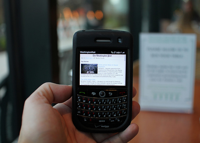
Blackberry photo by Mr. T in DC on Flickr

If you have a Blackberry, you can use Geoloqi right now. Currently, the Geoloqi app is in beta testing. The first Geoloqi app release is for iPhones running 4.0 or later, however, Geoloqi has Instamapper integration, which means that you can use Geoloqi, including sending yourself Geonotes, if you have a Blackberry or Android. The only difference is that you’ll have to use the Geoloqi.com website to leave yourself Geonotes – only the iPhone version will allow you to do it from the phone.

1. Log into http://beta.geoloqi.com and enter your phone number in the field provided. Then go to http://beta.geoloqi.com/settings/connections. Under “Geolocation Services” you’ll see “Instamapper Device Key”. Click the “Create” button. A Device Key will appear shortly afterward.

2. Install the “GPS Tracker” application from BlackBerry App World or download it over the air: http://www.instamapper.com/download/GPSTrackerBB.jad
For BlackBerry Storm, you can also try this binary with a higher resolution icon: http://www.instamapper.com/download/GPSTrackerStorm.jad

3. Start the application (look for an icon that looks like a satellite) and enter the 13-digit device key you got from the Geoloqi website.

Usage Notes:

  • Press the red hangup key to run GPS Tracker in the background.
  • Press the “Escape” key to quit tracking.
  • To have GPS Tracker start automatically when the phone boots, check “Auto-start on boot” in settings.

During the first few days of operation, the application will periodically pop into foreground. This is done to minimize the possibility that someone would use our service to track another person covertly (which is against our terms of service). Press the red hangup key to hide the application when it surfaces.

Notes on Support
All recent BlackBerries (OS version 4.2.1 and later) are supported. In particular, almost any BlackBerry bought from AT&T and Sprint should work out of the box. Note, however, that many BlackBerries do not have built-in GPS and need an external GPS receiver. Additionaly, some carriers (most notably Verizon) disable GPS access on their BlackBerries. If you have a Verizon phone, it will most likely not work. Corporate phones may also restrict access to network and/or GPS.

Enjoy using Geoloqi! If you run into any problems, or would like more information on how Geoloqi works, see Geoloqi Help. If you don’t find what you’re looking for, feel free to ask a question! We’ll be there to answer it.

Flickr photo credit: Mr. T in DC.