Posts Tagged ‘instamapper’

Posted

Tue Jan 4 2011, 5:17pm

By caseorganic

Categories

Tutorials

Tagged

How to Use Geoloqi with an Android Phone

Note: Geoloqi no longer works with Instamapper

Note: This tutorial used InstaMapper, a free GPS tracking and location sharing service. After nearly 5 years of operation, the site shut down on December 13th, 2012. There are now dedicated Geoloqi apps for Android. You can now download Geonotes or Geotracks for Android.
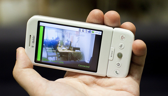
Flickr photo by tomsun

If you have an Android or Blackberry, you can use Geoloqi right now. Currently, the Geoloqi app is in beta testing. The first Geoloqi app release is for iPhones running 4.0 or later, however, Geoloqi has Instamapper integration, which means that you can use Geoloqi, including sending yourself Geonotes, if you have a Blackberry or Android. The only difference is that you’ll have to use the Geoloqi.com website to leave yourself Geonotes – only the iPhone version will allow you to do it from the phone.

1. Log into http://beta.geoloqi.com and enter your phone number in the field provided. Then go to http://beta.geoloqi.com/settings/connections.

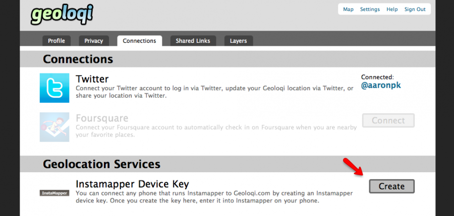
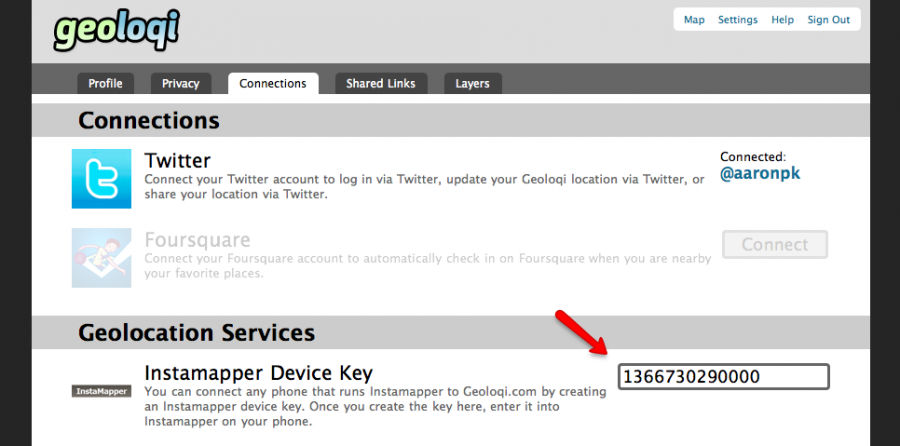
Under “Geolocation Services” you’ll see “Instamapper Device Key”. Click the “Create” button. A Device Key will appear shortly afterward.

2. Go to the Android store on your phone and find a free app called GPS Tracker by Instamapper.

Download the app and start running it. Click on “Menu” and click on “Settings”. You’ll see a field to enter your device key that you generated on Geoloqi. Enter that key there.

The rest of the settings concern what interval you’d like the GPS tracker to track at. Setting the tracker to track every 5 seconds will wear down your battery more quickly, but it will give you a very high resolution trail to look at on your map on Geoloqi.com. Set the buffer size at 100, and don’t worry about the Units. Imperial is fine. Setting Minimum accuracy (ft) to 1000 is also recommended. This way, Geoloqi will ignore points that are less accurate than 1000ft.

General Functions:
Press the “Menu” key to bring up settings.
Press the “Home” key to run GPS Tracker in the background.
Press the “Back” key to quit tracking.

A note on battery life:
GPS is powered on continuously for send intervals less than 121 seconds. If you want better battery life, set the send interval to at least 121 seconds. This will cause GPS Tracker to go to sleep in-between updates.

From there on out, you can use all the features of Geoloqi available on the website. Click on your map to see your history, share a link with others, and send yourself a Geonote by drawing a radius on the map, writing a message, and clicking send. If you share your location with someone, they’ll get a mobile version of your trail on their mobile phone, and a web version of your trail on the web.

You can toggle your privacy options at http://beta.geoloqi.com/settings/privacy and see your list of shared links at http://beta.geoloqi.com/settings/share. All of your account settings are at http://beta.geoloqi.com/settings/profile.

Finally,if you want to quickly access your map, you can easily do so by going to http://beta.geoloqi.com/username or where the username is the id of the Twitter account you used to sign in. If you didn’t sign in with Twitter, go to the connections tab in Geoloqi to connect your Twitter account. You’ll then be able to easily access your Geoloqi account by username URL.

Additional Help
If you have more questions, see Geoloqi Help. If you can’t find what you need there, please ask a question! We’ll get to it as quickly as we can.

Flickr photo by tomsun.
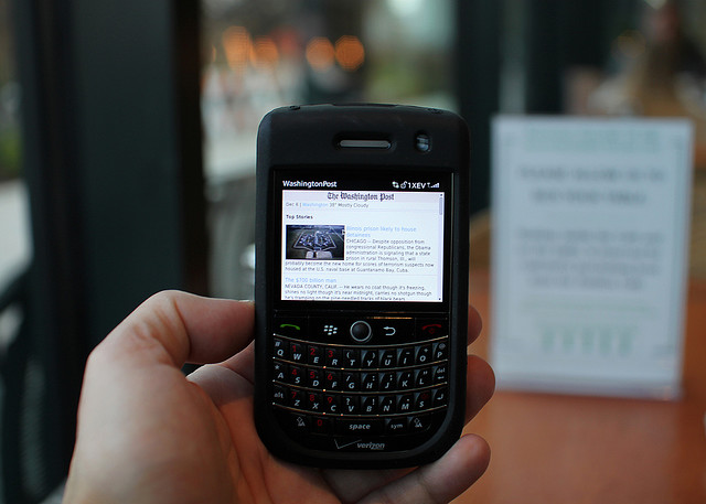
How to Use Geoloqi with a Blackberry Phone

Note: Instamapper no longer supports Blackberry. This tutorial is now expired.

Blackberry photo by Mr. T in DC on Flickr

If you have a Blackberry, you can use Geoloqi right now. Currently, the Geoloqi app is in beta testing. The first Geoloqi app release is for iPhones running 4.0 or later, however, Geoloqi has Instamapper integration, which means that you can use Geoloqi, including sending yourself Geonotes, if you have a Blackberry or Android. The only difference is that you’ll have to use the Geoloqi.com website to leave yourself Geonotes – only the iPhone version will allow you to do it from the phone.

1. Log into http://beta.geoloqi.com and enter your phone number in the field provided. Then go to http://beta.geoloqi.com/settings/connections. Under “Geolocation Services” you’ll see “Instamapper Device Key”. Click the “Create” button. A Device Key will appear shortly afterward.

2. Install the “GPS Tracker” application from BlackBerry App World or download it over the air: http://www.instamapper.com/download/GPSTrackerBB.jad
For BlackBerry Storm, you can also try this binary with a higher resolution icon: http://www.instamapper.com/download/GPSTrackerStorm.jad

3. Start the application (look for an icon that looks like a satellite) and enter the 13-digit device key you got from the Geoloqi website.

Usage Notes:

  • Press the red hangup key to run GPS Tracker in the background.
  • Press the “Escape” key to quit tracking.
  • To have GPS Tracker start automatically when the phone boots, check “Auto-start on boot” in settings.

During the first few days of operation, the application will periodically pop into foreground. This is done to minimize the possibility that someone would use our service to track another person covertly (which is against our terms of service). Press the red hangup key to hide the application when it surfaces.

Notes on Support
All recent BlackBerries (OS version 4.2.1 and later) are supported. In particular, almost any BlackBerry bought from AT&T and Sprint should work out of the box. Note, however, that many BlackBerries do not have built-in GPS and need an external GPS receiver. Additionaly, some carriers (most notably Verizon) disable GPS access on their BlackBerries. If you have a Verizon phone, it will most likely not work. Corporate phones may also restrict access to network and/or GPS.

Enjoy using Geoloqi! If you run into any problems, or would like more information on how Geoloqi works, see Geoloqi Help. If you don’t find what you’re looking for, feel free to ask a question! We’ll be there to answer it.

Flickr photo credit: Mr. T in DC.

Posted

Mon Nov 22 2010, 11:11am

By caseorganic

Categories

Events

Tagged

Building a Location-Based Science Trivia Game with Geoloqi at Science Hack Day, San Francisco

Last week, the Geoloqi team headed down to Palo Alto last week for Science Hack Day, a 48 hour hacking event that brought together scientists and technologist, artists and futurists, for a weekend of development, gaming and overall enjoyment. Many of us slept at the event, while some stayed up hacking into the night.

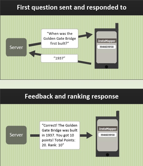
We arrived at Science Hack Day with the goal of making an experience that gets people to pay attention to the world around them. During gameplay, players walk around town and receive location-based questions via SMS related to education and science and their nearby location.

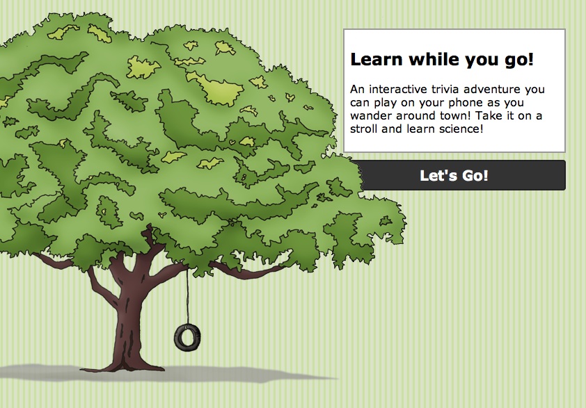
Location-based science trivia game at Science Hack Day

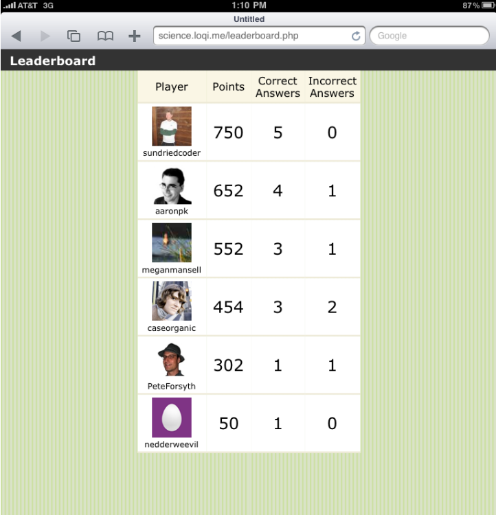
Each question was worth points, and more points are awarded for correct responses than incorrect responses. Those with the highest scores are listed on a leaderboard.

Science Notes Leaderboard

Players used a GPS Tracker made by Instamapper to play the game.

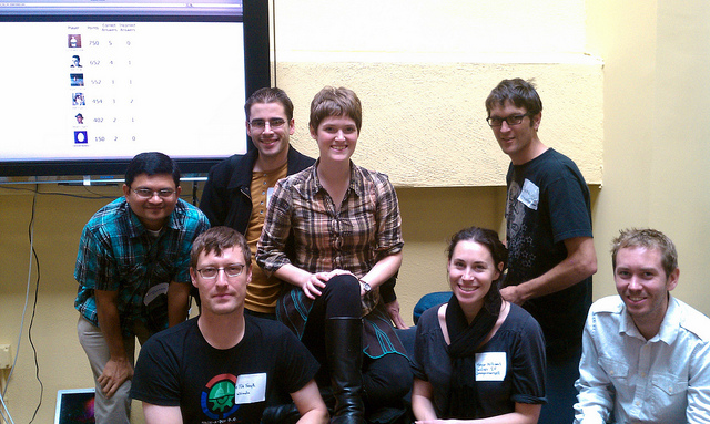
Science Hack Day Team Geoloqi

Thanks to all those who helped us with development and testing! Kevin Rohling, Liam Holt, Megan Mansell, Devin Drew, Pete Forsyth, Ashish Mahabal and Jennifer Monfrans.

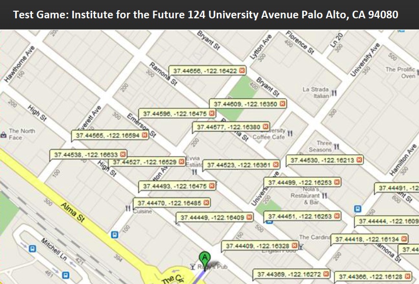
Test Game Lat Long Markers

We left questions at a number of locations around the Institute for the Future, where the conference was being held.

Question Response

Questions and Responses

Questions were sent to a player’s phone by SMS, and they were given points based on their response. Most questions dealt with the area right around the user.

To respond, the player simply send a reply back to the SMS number and the database checked whether the response was correct or not and added points to the user’s id.

Application Architecture

Application Architecture

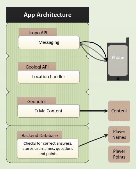
We used the Tropo API to send the SMS messages to users as they walked around town.

Geoloqi acted as the location-handler, determining where players were.

Finally, the trivia content was stored in a database built by Kevin Rohling.

Player ids and point tallies were handled there and displayed on the leaderboard.

Thank You!

Thanks again to everyone who joined in the game! It made Science Hack Day a blast. Thanks to Ariel Waldman for organizing it, and Jeremy Keith for coming up with the concept in the first place.

Geoloqi-Powered ChatterCast Wins Seattle Open Government Hackathon!

This weekend we participated in the Gnomedex10 Open Government 24 hour Hackathon. Tropo sponsored a lounge at the Edgewater hotel with food, coffee, wifi and couches for open data geeks to build apps in. Participants were encouraged to make the best app using the Tropo API and data.seattle.gov (powered by Socrata).

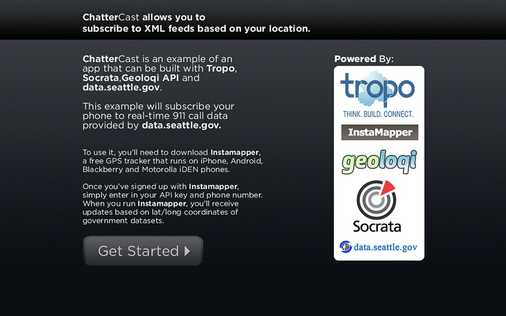
We quickly realized that we could use the Geoloqi API to build a local emergency alerter app that could run on almost any platform. In the span of around 5 hours (plus about 4 hours getting the Geoloqi API ready), we built ChatterCast, a app allowing one to subscribe to XML feeds based on one’s location. We used the Geonote methods of the Geoloqi API to handle delivering the location-specific messages. Geoloqi used Tropo to deliver SMS messages to the phone.

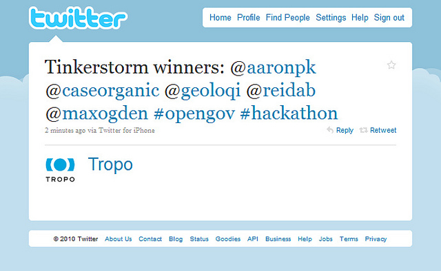
We finished with just enough time to present before we had to catch our train back to Portland. We had to leave before we were able to see many of the other presenters. We caught about half of a great presentation by Portland geohackers and open gov enthusiasts Reid Beels and Max Ogden. Their app notified users the day before events happened in user-specified ‘watch zones’, e.g. road closures on your commute. They won for best use of Tropo, another success for Portland’s open government community!

Note that the app is simply a proof of concept. While it fully works, it requires installing Instamapper on your mobile phone. Instamapper runs on most mobile phones, including some older Motorola models such as the Boost Mobile phone. This means that even some users with older phones can still have access to this data with ChatterCast. If you’re unfamiliar with Instamapper, we wrote a post on it here.

Here’s an example Geonote SMS message from the data.seattle.gov 911 call dataset.

We had a great time building this app! Now we have a framework for digital storytelling and geolocal data. Anyone can use Tropo, Instamapper and the Geoloqi API to build their own app capable of pushing XML data to a user by SMS. We’ll be integrating ChatterCast into the Geoloqi API so that the mashup can be more accessible to developers and end users.

Thanks again to Tropo, Socrata, data.seattle.gov, Gnomedex and all of the great open data hackers at the #tinkerstorm hackathon event!

For more about Geoloqi, and to sign up to beta test, see Geoloqi.com. If you’d like to contribute as a developer, check out the Developer Wiki. To use the rapidly developing API, try the Geoloqi API!

Posted

Sun Aug 22 2010, 3:15pm

By caseorganic

Categories

Tutorials

Tagged

How do I get my Instamapper Device and API Key?

Note: Geoloqi no longer works with Instamapper

Note: This tutorial used InstaMapper, a free GPS tracking and location sharing service. After nearly 5 years of operation, the site shut down on December 13th, 2012.

You can track your location on a number of devices other than the iPhone using Instamapper. You can use all the features of Geoloqi by importing your Instamapper data. To do it, you’ll need Instamapper for iPhone, Android, Blackberry or some Motorola phones.

Here’s how to get your Instamapper device key.

Download Instamapper: iPhone iTunes Link. You can also find it in the Android Market called “GPS Tracker” by Instamapper.

Log in to your Geoloqi account and go to the “Connections” screen. Click on “Create” in the Instamapper section.

In a few seconds, you should get a device key. Enter the Device Key into the settings on your Instamapper app on your iPhone.

Enter your phone number in your profile page so you can receive SMSs. When Instamapper is running on your phone, you will be able to see your location in Geoloqi, and send shared links and geonotes from the website!