Posts Tagged ‘geotrigger’

Posted

Tue Nov 19 2013, 5:17pm

By caseorganic

Categories

API
News

Tagged

Beta Launch of the Esri Geotrigger Service!

Today we launch the public beta version of Esri’s Geotrigger™ Service! This allows developers to add location awareness and location-based alerts to apps for iPhone and Android. There’s so much excitement around this particular service—of the many we provide to developers (think geocoding, routing, geoenrichment, and of course maps).

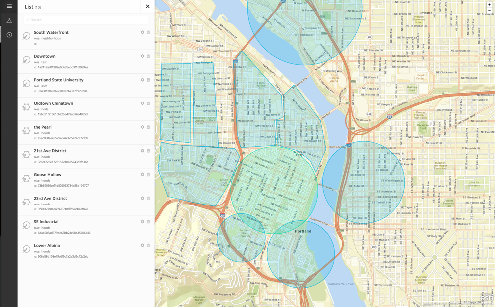
How does it work? An invisible area on a map has an action or message associated with it. When your mobile device crosses into the “trigger zone” the Geotrigger Service sends a location-based message to that device, or even notify your server for custom events.

Here’s what you need to know:

  1. The Geotrigger Service runs in the cloud. That means all you have to do is add the Geotrigger SDK to your application, set up push notifications, and associate your client ID with the service. Finally, define your geofences, push notifications into the service, and begin testing your location-aware apps.
  2. The Geotrigger Service provides a new level of functionality for your apps! Now your apps can easily send messages to users when they arrive at or leave areas you define with a geofence. And, quickly gather business intelligence such as where people are and what time it is when the app is used.
  3. Stop worrying about battery drain. Have you used a location-based app and watched your battery drain? Our service reduces battery drain when running location-based apps.
  4. Free while in beta. ArcGIS Online subscribers are invited to try the Geotrigger Service API and its iPhone and Android SDKs for free until its final release in early 2014. We’ll use your feedback to shape the future of the service.
  5. The sky is the limit. We cannot think of any industry that would not benefit from an app built using the Geotrigger Service. Here’s some examples:

Retail and Loyalty: Engage customers with personalized content and deals the moment they enter a store.

Real Estate: Send messages to prospective home buyers when their search criterion matches a home nearby.

Energy Management: Use your location to automatically manage power consumption in your home or office.

Tourism: Bring public attractions to life by informing tourists of interesting locations as they explore your city.

Public Alerts: Notify citizens about events such as road closures or civic emergencies based on past locations.

Ready to build your next app with the Geotrigger Service to your app? Check out https://developers.arcgis.com/en/geotrigger-service/
Posted

Wed May 15 2013, 12:12pm

By Aaron Parecki

Categories

News

Tagged

Here’s why we’re excited about the new Android Location APIs

The ArcGIS Geotrigger Service leverages the latest Android and iPhone technology, when these services improve, our technology improves. Our goal is to make the best cross-platform location services for developers, leveraging the best capabilities of the native location services available for existing consumer devices.

On the iPhone, we’ve leveraged the native geofencing APIs to offer improved battery life compared to using the GPS directly. On Android, there have been minimal location services available from the SDK, essentially limited to turning the raw GPS device on or off.

Three new location APIs were announced today at Google I/O. This is great news for anyone building location-based applications. We’ve been eager for Google to improve the Android location services.

Fused Location Provider

The Fused Location Provider utilizes all of the communication sensors in the phone including wifi, GPS, and cell network, while using only 1% of the battery that previous APIs used.

This is a new service that will greatly improve any application that uses location services. We will improve the ArcGIS Geotrigger SDK for Android significantly by taking advantage of the new Location Provider. Expect to see much better battery life on the Android Geotrigger SDK in the future!

Geofencing

The new Google Geofencing APIs allow apps to respond to the user entering or exiting a configured geofence. The API allows each app to define 100 geofences simultaneously.

This is great news for the ArcGIS Geotrigger SDK, since we will be able to leverage this service to provide better battery life and performance in the SDK. Previously we were limited to turning on and off the GPS device. Now we will be able to use the geofencing API in combination with our optimization algorithms to better provide our Geotrigger service.

Activity Recognition

The new Activity Recognition API uses machine learning classifiers to determine whether the user is walking, cycling or driving. Apps will be able to adjust their behavior depending on the user’s mode of transport. This is done in a very battery efficient way, no GPS is required.

We will leverage this new API to make further improvements to managing the native location services, and it should open up possibilities for some interesting new apps to be built.

The ArcGIS Geotrigger Service

The ArcGIS Geotrigger Service allows developers to easily manage Geotrigger rules with a simple cloud-based API, while also supporting geofences defined as polygons. You can configure an essentially unlimited number of Geotrigger rules in the API, and only the nearby ones will be synced to the phone, making it easy to handle the limitations of the native APIs.

Many of the battery life issues people experience are due to poor implementations of using the Apple and Android location services. It’s easy for a developer to leave the GPS on all the time, but that drains battery quickly. The Geotrigger SDK efficiently manages the native location services and optimizes the server communication required to send location data, saving battery life wherever possible.

The improvements to the Android location APIs are fantastic news and will result in improved Geotrigger services and a better experience for developers!


Aaron Parecki
CTO, Esri R&D Center, Portland

Amber Case
Director, Esri R&D Center, Portland