Posted

Thu Sep 23 2010, 12:12pm

By Aaron Parecki

Categories

Events

Tagged

Geosketching – Cyborgs are Mapping Portland

The Grassy Knoll Gallery presents:

Geosketching – Gallery Show and CyborgCamp Pre-Party

Grassy Knoll Gallery
123 NW 2nd Ave
Portland, Oregon 97209
Friday, Oct 1st, 2010 6-9 PM

Exhibition Dates // Oct 1 – 29
Artist Reception // Friday, Oct 1st, 2010 6-9 PM. Free and open to the public
Gallery Hours // by appointment
DJ set by Let’s Go Outside
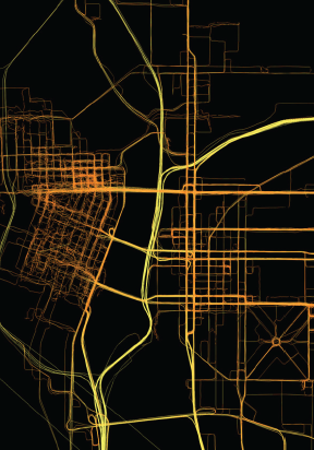
Where a person goes can reveal a lot about who they are and how they live. Thousands of people can live in the same city and have drastically different experiences.

GPS maps are a kind of technogeographical self portrait; a way of showing how one has lived during a certain period of time. The methods for taking data can reveal something about a person as well. There is no standard way of taking GPS data. One’s map may differ greatly from another. For the past two years, Aaron Parecki has been carrying a GPS tracker with him at all times, walking, busing, biking, driving and flying. Amber Case has been taking data since January 2010. Together, they have logged over 10 million GPS points. These points have been plotted onto paper, then color-coded by time of day and speed of movement to render beautiful and thought provoking prints that serve as “geotechnological” self-portraits.

Portland-based PHP developer and GPS enthusiast Aaron Parecki experiments with automatic location check-ins and proximal notification systems. He also began using GPS to control the lights in his house and perform other automated actions.

Amber Case is a Cyborg Anthropologist from Portland, Oregon. She studies the interaction between humans and computers and how our relationship with information is changing the way cultures think, act, and understand their worlds.

Together the two founded Geoloqi.com in an effort to make GPS tracking and advanced co-location protocols available to the general public.

How Can I Do This?

Geoloqi, a GPS tracker app for iPhone, Android, Blackberry and Palm is in constant development. It will allow anyone to take data and make maps like these. If you’d like to beta test or help us develop it, sign up at Geoloqi.com or follow @geoloqi on Twitter.

Geosketching will also be an opening celebration for the upcoming Cyborg Camp Portland 2010 on October 2nd.

About Cyborg Camp

CyborgCamp is an unconference about the future of the relationship between humans and technology. Topics discussed include, but are not limited to, social media, design, code, inventions, web 2.0, twitter, the future of communication, cyborg technology, anthropology, psychology, and philosophy.
For more information and to register go to portland.cyborgcamp.com or contact Amber Case.

Fashionbuddha Studio creates world-class animations and interactive experiences. Fashionbuddha Studio is featured in Communication Arts Design and Interactive Annual, how Magazine, and Best of Show at the 2009 Webvisionary Awards. www.fashionbuddha.com

About the Grassy Knoll Gallery

The Grassy Knoll Gallery began in August 2007 as a venture between Robert Lewis, owner of Fashionbuddha Animation Studio, and curator Renee Marcotte. Located on the second floor of the historic Merchant Hotel in Old Town, Grassy Knoll Gallery provides a unique outlet for illustrators and animators.

For more information on past, current and future shows or to purchase artwork online, please visit our website at www.grassyknollgallery.com.

Posted

Fri Sep 10 2010, 8:20pm

By caseorganic

Categories

Events

Post-CyborgCamp Open Government Hackathon: 8 Hours of Open Source Action on Sunday, Oct. 3rd!

Geoloqi and Tropo will be sponsoring an 8-hour hackathon to see who can build the best open government application in just one day!

It’s free! You can participate as an individual or a team. Prizes will be awarded to the winners by the Hackathon Partners. Breakfast, lunch, coffee and beer will be available throughout the day, and there will be high speed Internet access and comfortable couches.

REGISTER HERE

Schedule

  • Breakfast and coffee will be served at 8:30am, followed by Lunch at Noon.
  • Coding will stop at 5:30pm, and teams and individuals will demo their apps.
  • Prizes will be awarded at 6:30Ppm.

Location

NedSpace Old Town, 117 NW 5th between Couch and Davis.

Backspace is right downstairs, Davis Street Tavern is right next door, there’s a parking lot across the street, and it’s right on the MAX line.

Who Should Attend?

Ruby, Python, PHP, web developers, coders, interaction designers, graphic designers and anyone who has a passion to code, hack or conceptualize applications that will free (or otherwise enhance) the accessibility and usefulness of government-shared data.

Although the sprint takes place On Oct 3rd after CyborgCamp Portland, you don’t have to be attending the conference to join us.

Participation is free and open to anyone… we just ask that you register in advance so we know how many individuals or teams we need to accommodate.

What’s Going to Happen?

There will be organizers onsite to help get things rolling. At 5:30pm, each app will be evaluated by the Hackathon Partners and prizes will be awarded to those teams or individuals that develop the best applications in the 8 hour. Participants need not show up right at 8:30am, but those who do will have the most time to code!

Hackathon Partners

Partners are companies and organizations that provide tools or services that can enhance open government apps. They’re also providing the prizes and will be choosing the winners. If your organization has tools or services that you think would be useful to the Hackathon, contact @aaronpk or @caseorganic and we’ll see about adding you to the list:

* Tropo – Tropo is a powerful yet simple API that adds Voice, SMS, Twitter, and IM support to the programming languages you already know.
* Geoloqi – A secure, real-time mobile and web platform for location sharing.

REGISTER HERE

Posted

Sun Aug 29 2010, 12:12pm

By Aaron Parecki

Categories

About

Tagged

Inherent Privacy

Geoloqi does not have a way to “friend” people on the network. Instead, Geoloqi takes a different approach to location sharing which more closely models real-life relationships.

Traditional social networks allow you to either be friends with someone or not. On Foursquare and Google Latitude you request permission to follow someone and then you see all of their checkins and location. Flickr has a tiered structure where you can mark people as a contact, a friend, or family. However, neither of these models accurately represents real relationships.

Respect the temporal nature of real-life relationships.

It is useful to share my location with a client I’m trying to meet at a coffee shop. However, I would never friend a client on Foursquare or Google Latitude. I wouldn’t necessarily want a client to know where I am all the time. On the other side of the coin, I also wouldn’t want to see where a client is all the time if they shared their location with me. Their location is only relevant to me if we’re trying to meet.

To more closely model the real relationships we have with people around location sharing, Geoloqi allows you to send an expiring link. You can set a time limit when the link will no longer show your updated location. This is a more accurate way to describe your relationship with your client: your client can only see your location for the 30 minutes leading up to your meeting.

Posted

Sat Aug 28 2010, 1:13pm

By caseorganic

Categories

Features

Tagged

Geonotes – Send Messages to Your Future Self

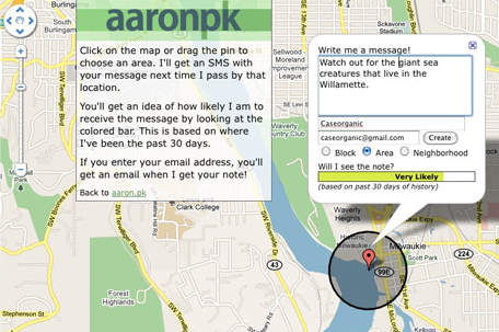
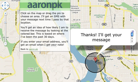
A Geonote is a location-based note that may be left for a user, and will send a message to the desired user only when that location is reached. Geonotes are based on the concept of “geofencing,” which involves detecting whether a GPS enabled mobile device has entered or exited a geographical radius. In the case of Geonotes, one can literally draw a circle anywhere on the planet, and if a GPS enabled device enters that radius, an SMS message will be sent to that device.

Try it!

Send us a Geonote: http://aaron.pk/geonote | http://caseorganic.com/geonote

Instead of showing site visitors where we are, the website uses the last 30 days of GPS data to determine whether or not we will be “likely” to pick up the Geonote, or rather, the likelihood of us traveling through the circumference of the Geonote that has been left. GPS-enabled phones can do other things too. For instance, there’s a Geonote GPS circle above our house that triggers an X-10 light system to turn on or off depending on whether we enter or leave the circle. The lightswitch evaporates and we no longer have to press it. The GPS enabled phone becomes a remote control for reality.

Geoloqi started because a lot of our friends wanted Geonotes but had no way of tracking GPS data on their phones. We began an open source project in our free time, and a number of volunteers began contributing code. Now we have a beta version of our GPS tracker running on iPhone and Android devices, and we no longer have to use older phone models to track GPS data.
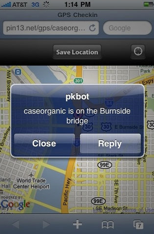
Uses for Geonotes:

For instance, 2 weeks ago I remembered that I needed to get some paprika next time I went to the store. I wasn’t near a shopping list, and I knew it would be lost if I wrote it down on a piece of paper. So, as I said in my tweet, I left a Geonote with a circumference that surrounded my local grocery store. When I next went to the grocery store, my phone detected that I had entered the radius I’d left the Geonote in before. I promptly received an SMS with the note to “Get Paprika!”. Needless to say, I got it.

When we first started sending out the Geonote link, my friend Don Park sent me some useful and entertaining Geonotes. He left one for me over the Hawthorne bridge in Portland, Oregon. When I crossed the bridge, I got a note that told me that the bridge was built in 1910 and that 4,800 cyclists crossed it daily. Suddenly, Geonotes allowed geography to become trivia. When I was on a hike on nearby Mt. Tabor, I received a Geonote from Don that told me that wild Blackberries were nearby, and that I should pick some.

Trip Planning:

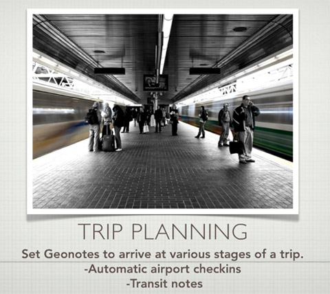
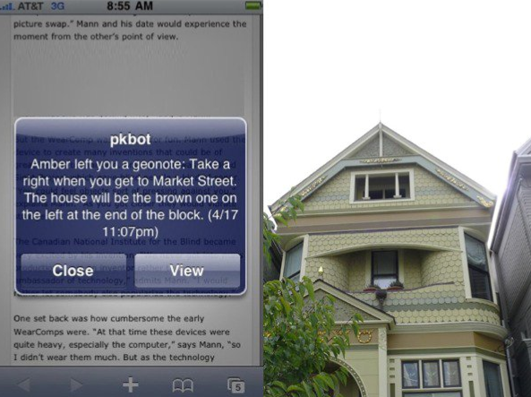
On a recent trip to San Fransisco for a conference, I set a series of Geonotes to greet me when I arrived at the airport. When I got off the plane, I got a note welcoming me to San Francisco. Then I got a note telling me which bus to take into town. When I got on the bus I didn’t have to worry when to get off, because I had set a Geonote that told me to get off the bus. When I got off the bus, the next Geonote told me the address of my friend’s house.

The difference between a normal travel experience and one traveling with Geonotes was that it saved me from looking down at my phone all the time to query my E-mail account for an address, bus stop or transit direction. The Geonotes allowed me to sit back and relax and live my life instead of pulling information out of a mobile device. Instead of pulling, the device pushed just in time information to me at the relevant points of my travel. These virtual post-it notes have been fun to experiment with.

About Geonotes and Geoloqi:

Geonotes are part of Geoloqi – a secure, open source platform and standard for location sharing developed by an open source developer community. When Geoloqi is released, everyone will be able to have their own Geonotes. There’s a longer slideshow about how it works here: http://www.slideshare.net/caseorganic/nonvisual-augmented-reality-with-sms-and-gps-open-source-bridge

You can leave a Geonote for Aaron and I here: http://aaron.pk/geonote http://caseorganic.com/geonote

Posted

Sat Aug 28 2010, 1:13pm

By Aaron Parecki

Categories

Events

Tagged

Software Association of Oregon – Location-Based Apps

There’s a message from your future and it’s telling you to remember to pick up milk.

Amber Case and her partner Aaron Parecki are the founders of Geoloqi. Geoloqi is a private, real-time mobile and web platform for secure location data, with features such as Geonotes, proximal notification, and sharing real-time GPS maps with friends. Geoloqi has been covered in the Willamette Week and Oregon Business. It has been presented at eComm, Open Source Bridge, Show and Tell PDX and Research Club under the alias Non-Visual Augmented Reality with SMS and GPS. Read CNN’s article on Geoloqi, “What’s Next for ‘Check-in’ Apps“.

What will you learn:

  1. Why developers of apps should look at what users want to do now, as well as what users want to do in their future.
  2. Why social apps should try to mirror real–world relationships
  3. Why sharing should be about who you share with as well as how long you want the information to be available.
  4. Why developers should think about making apps “ambient” and require less user interaction.

Tickets are $15. Register for the event here.