Posted

Fri Aug 27 2010, 10:10am

By Aaron Parecki

Categories

Press

Tagged

CNN Tech: What’s Next for Check-in Apps?

John D Sutter writes: “An open-source group called geoloqi is trying to take that idea of an automated check-in radius even further.

The volunteer group of app developers, which is based in Portland, Oregon, is working on a website and app that will help trigger events if and when a person walks up to certain pre-set locations.

For example, you would be able to set the app to text you your shopping list when you went within a certain distance of your favorite grocery store.

Or, if you didn’t show up to work by 9 a.m., you could set the app automatically to e-mail your boss saying that you’re late, said Aaron Parecki, geoloqi’s founder.

“We’re calling these geonotes,” he said, “and these are location-based notes so you can leave yourself a note that is tied to a location and pops up when you’re there.”

The site and the app should be up and running in about a month, he said. Geoloqi won’t be a social network, exactly, but it could be integrated into Foursquare, Gowalla or other location-based networks, he said. The group has one new project up — it’s a Seattle, Washington-based website that can send you a text message, in real time, when a 911 call is placed within a certain radius of you.”

Read the full article at cnn.com

Posted

Tue Aug 24 2010, 6:18pm

By Aaron Parecki

Categories

Press

Tagged

Tropo is Easy!

Chris Mattieu writes: “Reflecting on the event, I wanted to share an interesting observation that I had during the course of the contest. The winners of the iPad, Amber Case and Aaron Parecki, were not originally in the contest. They were hanging out with us at the event working on their totally awesome side project called GeoLoqi. Halfway through the event, Aaron looks in my direction and says that he is interested in integrating Tropo SMS with GeoLoqi. Several minutes later his iPhone buzzes with an SMS and he looks at me and Amber and says, “It worked! GeoLoqi just me an SMS notification triggered by my location!” This was certainly very exciting for all of us but it the event gets more interesting…

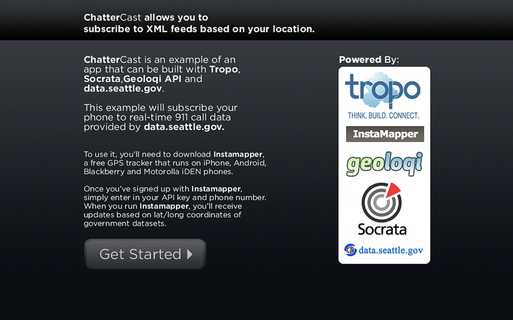
Amber and Aaron left to get some sleep and came back in the morning for breakfast with an idea to enter the contest. Their idea was ChatterCast, a mashup of Tropo, Socrata’s data.seattle.gov, Instamapper, and GeoLoqi services. Basically ChatterCast subscribes your phone to real-time 911 call data provided by http://data.seattle.gov. ChatterCast alerts you based on your location of 911 events happening around you.

This is a great example of how someone with an idea can not only win a contest only after getting started in the final hours but how anyone with an idea can change the world. Tropo’s ease of use makes it super easy to communicate with telephones via voice and SMS or even IM and Twitter with a couple of lines a code. There’s no reason not to add telephone support to your existing web applications to make them even more powerful in this mobile and social age we live in today.”

Read the full article on blog.tropo.com

Geoloqi-Powered ChatterCast Wins Seattle Open Government Hackathon!

This weekend we participated in the Gnomedex10 Open Government 24 hour Hackathon. Tropo sponsored a lounge at the Edgewater hotel with food, coffee, wifi and couches for open data geeks to build apps in. Participants were encouraged to make the best app using the Tropo API and data.seattle.gov (powered by Socrata).

We quickly realized that we could use the Geoloqi API to build a local emergency alerter app that could run on almost any platform. In the span of around 5 hours (plus about 4 hours getting the Geoloqi API ready), we built ChatterCast, a app allowing one to subscribe to XML feeds based on one’s location. We used the Geonote methods of the Geoloqi API to handle delivering the location-specific messages. Geoloqi used Tropo to deliver SMS messages to the phone.

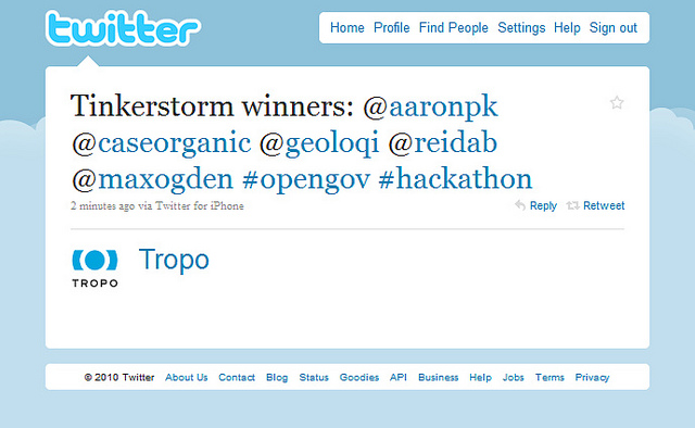
We finished with just enough time to present before we had to catch our train back to Portland. We had to leave before we were able to see many of the other presenters. We caught about half of a great presentation by Portland geohackers and open gov enthusiasts Reid Beels and Max Ogden. Their app notified users the day before events happened in user-specified ‘watch zones’, e.g. road closures on your commute. They won for best use of Tropo, another success for Portland’s open government community!

Note that the app is simply a proof of concept. While it fully works, it requires installing Instamapper on your mobile phone. Instamapper runs on most mobile phones, including some older Motorola models such as the Boost Mobile phone. This means that even some users with older phones can still have access to this data with ChatterCast. If you’re unfamiliar with Instamapper, we wrote a post on it here.

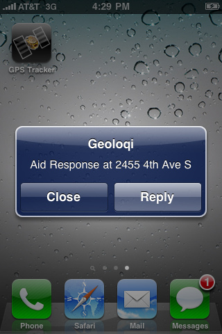
Here’s an example Geonote SMS message from the data.seattle.gov 911 call dataset.

We had a great time building this app! Now we have a framework for digital storytelling and geolocal data. Anyone can use Tropo, Instamapper and the Geoloqi API to build their own app capable of pushing XML data to a user by SMS. We’ll be integrating ChatterCast into the Geoloqi API so that the mashup can be more accessible to developers and end users.

Thanks again to Tropo, Socrata, data.seattle.gov, Gnomedex and all of the great open data hackers at the #tinkerstorm hackathon event!

For more about Geoloqi, and to sign up to beta test, see Geoloqi.com. If you’d like to contribute as a developer, check out the Developer Wiki. To use the rapidly developing API, try the Geoloqi API!

Posted

Sun Aug 22 2010, 3:15pm

By caseorganic

Categories

Tutorials

Tagged

How do I get my Instamapper Device and API Key?

Note: Geoloqi no longer works with Instamapper

Note: This tutorial used InstaMapper, a free GPS tracking and location sharing service. After nearly 5 years of operation, the site shut down on December 13th, 2012.

You can track your location on a number of devices other than the iPhone using Instamapper. You can use all the features of Geoloqi by importing your Instamapper data. To do it, you’ll need Instamapper for iPhone, Android, Blackberry or some Motorola phones.

Here’s how to get your Instamapper device key.

Download Instamapper: iPhone iTunes Link. You can also find it in the Android Market called “GPS Tracker” by Instamapper.

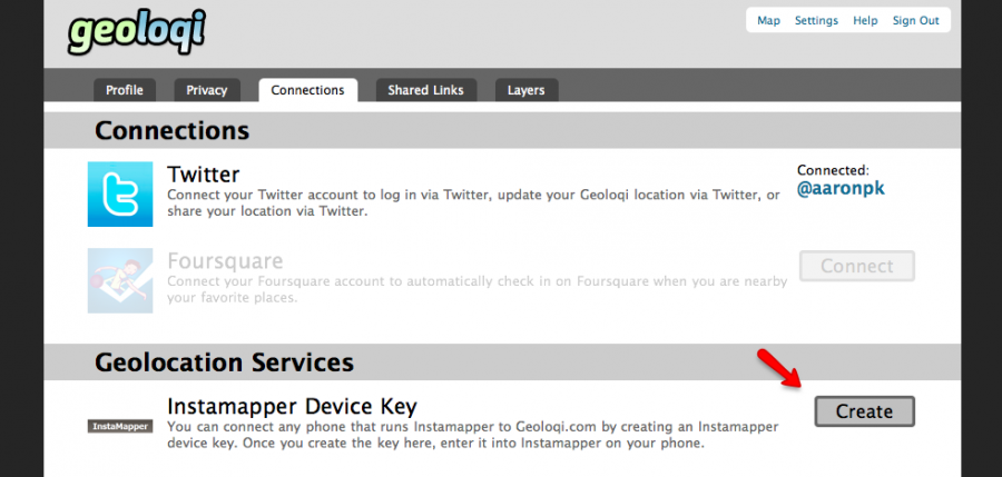
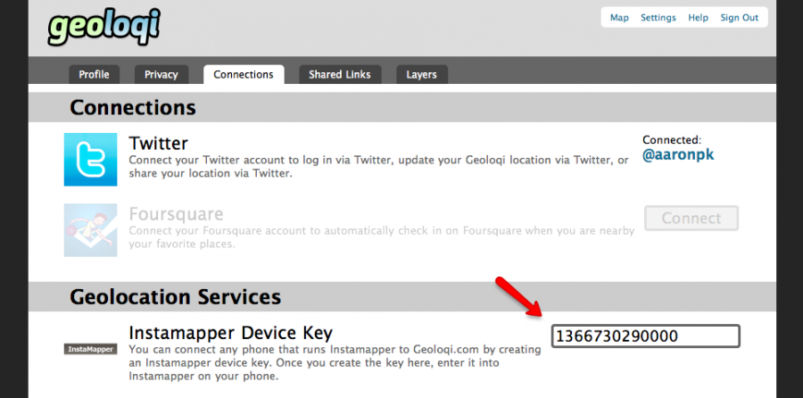
Log in to your Geoloqi account and go to the “Connections” screen. Click on “Create” in the Instamapper section.

In a few seconds, you should get a device key. Enter the Device Key into the settings on your Instamapper app on your iPhone.

Enter your phone number in your profile page so you can receive SMSs. When Instamapper is running on your phone, you will be able to see your location in Geoloqi, and send shared links and geonotes from the website!

Posted

Wed Jul 14 2010, 4:16pm

By Aaron Parecki

Categories

Press

Portland Mercury – Tonight Recess Gallery Presents Social_Net_Works

Matt Stangel writes: “l’m most intrigued by Aaron Parecki and Amber Case’s GPS-generated self-portraits. Parecki has been logging his location every seven seconds via a mobile GPS tracker for the last two years; and for the past six months, Case has been doing the same. Using the GPS data gathered, experiential portraits have been generated, representing the artists’ lives not in literal pictures of the body, but in images of where the body has been— plotting the artists’ movements onto maps, and color-coding these movements under variables like time of day, speed of movement, etc.. See some examples here, or stop by Recess tonight.”

Read the full article at portlandmercury.com

×

The Geoloqi service was acquired by Esri in 2012, and was shut down in 2015.

Please visit developers.arcgis.com for information on Esri services that replace the Geoloqi API.