Posts Tagged ‘gps’

MapAttack Weekend Timelapse Footage!

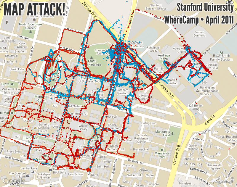
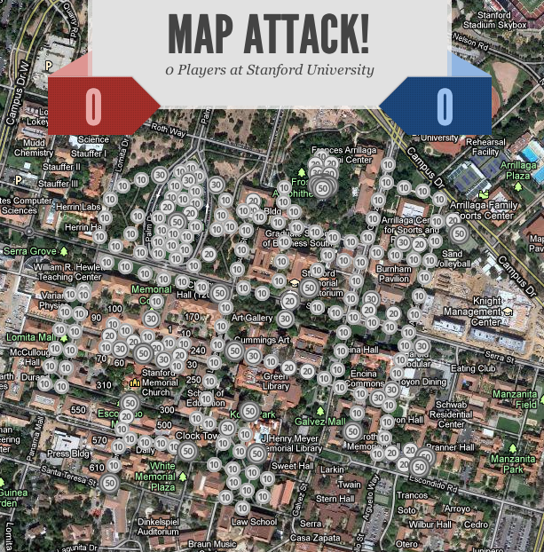
Aaron Parecki created a visualization of the territory captured by each team during gameplay. Below is a visualization of the GPS trails of the players during the games. Each dot represents a snapshot of the position of each player taken every 1-10 seconds.

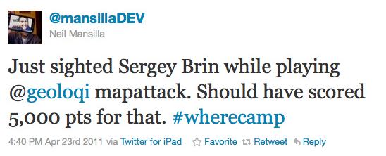
Some of the players experienced interesting events, such as seeing a marching band with Stanford students dressed as pine trees play on campus. Another player found something even more interesting:

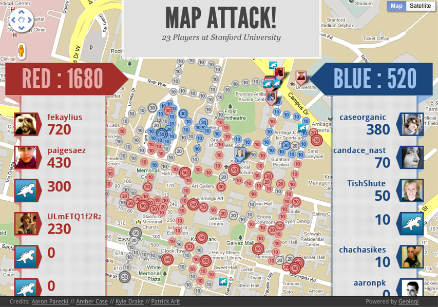
Final Game Results

Again, red completely won over blue! It was an epic battle filled with kids and bikes and many points.

You can see a replay of the games in the video below!

MapAttack at WhereCamp 2011 from aaronpk on Vimeo. Thanks to Sam Churchill for contributing video footage!

Bring MapAttack to your city, school or company!

Want to bring a game to your school or company? Contact us at mapattack at geoloqi dot com or here and we’ll be glad to help you out! You can also follow @playmapattack on Twitter for the latest games and news! We’ll be bringing it to more campuses and cities starting in June 2011.

Giant Thanks!

Again, giant thanks to Aaron Parecki and Kyle Drake for development and Patrick Arlt for design. Enormous thanks to Reid Beels and Audrey Eschright for helping keep the server stable during Friday’s game! Making a game like this has been a dream of mine since WhereCamp Portland 2008. It’s great to see it come to life!

Posted

Fri Apr 22 2011, 3:15pm

By caseorganic

Categories

Events

Tagged

Results from the MapAttack at Stanford University!

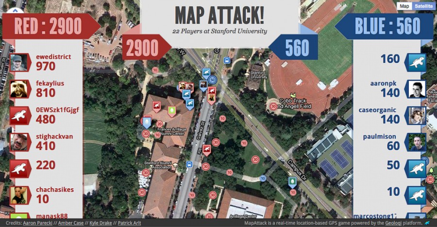
This morning a bunch of us at WhereCamp headed out to play MapAttack, a game based on the Geoloqi platform. Players subscribed to the MapAttack layer in the Geoloqi app and were assigned to a red or blue team. 

The game quickly progressed as people rushed out to collect dots. Some, riding on bikes, grabbed points faster than others. Others, like @paigesaez, aimed for large points, finding and capturing 50 point dots before anyone else.

Mobile App

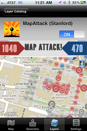
Here’s what the MapAttack game looked like on the phone. The leaderboard updated in real time, and everyone’s locations and movements could be seen. The fierce battle between red and blue teams progressed over time.

A Rush to the Finish

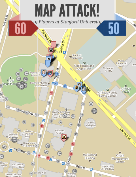
Red dominated in the lead over Blue through most of the game.

One of the players who got most of the red team’s points on the map told us a story of how one of the points was stuck in the middle of a construction site. He went up the construction worked and asked him if he could carry the phone into the site and hold it there until the point was received. That led to an interesting discussion on real-life apps and games between him and the worker. Had he not been playing the game, he would not have had the conversation or even talked to the worker.

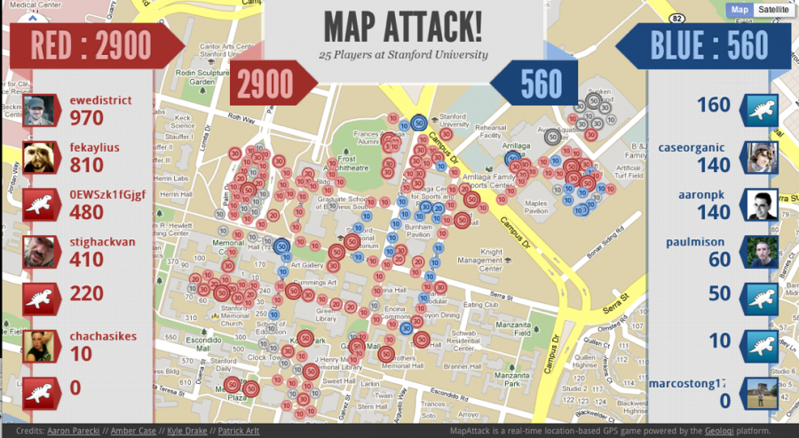
Red won the game! You can see the end state of the game here!

Drawing pictures with GPS

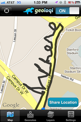
@mpanighetti and @aaronpk went out to draw the word Where on a part of the Stanford University campus. They cranked up the tracker and ran around in the shape of the word.

There have been a bunch of pieces of GPS art created with the Geoloqi app. If you have one, send it to us at art at geoloqi dot com! We’ll put it up in a gallery in the future!
Thanks a bunch!
Thanks to everyone who played and worked on the app. We can’t wait to improve it and bring it to more people! You can keep up on future games by following @playmapattack.

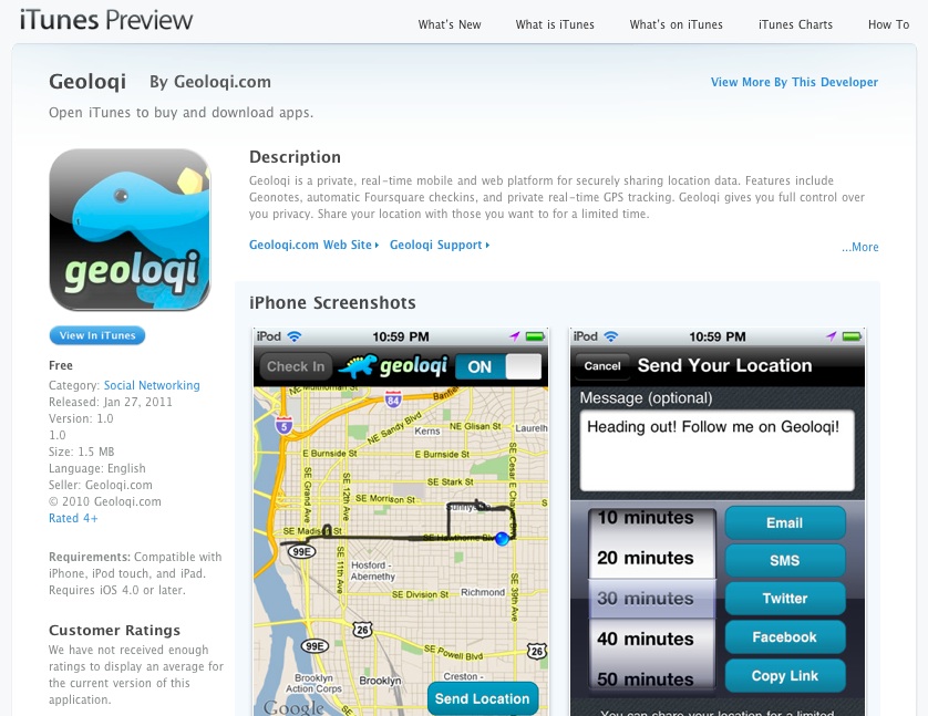
Geoloqi for iPhone now in the app store!

After nearly a year of planning, testing and development Geoloqi for iPhone is now in the app store!

This is the first version. Many more features will be added over time. Thanks to everyone who helped build, test, design and suggest features! There will be more to come, including more layers, a layer builder, advanced Geonotes and more in upcoming releases.

You can download Geoloqi for iPhone here.

Geoloqi in the app store!

What is Geoloqi?

Geoloqi is a private, real-time mobile and web platform for securely sharing location data. Features include Geonotes, automatic Foursquare checkins, and private real-time GPS tracking. Geoloqi gives you full control over you privacy. Share your location with those you want to for a limited time.

The GPS tracker runs in the background, and has full tracking settings. Choose from high resolution tracking, battery saver mode or your own custom settings. Worried about battery consumption? You’ll get a warning when your battery gets too low.

Geoloqi for iPhone

Features in this release:

  • Automatic Foursquare Checkins for your favorite places
  • Send Geonotes from the phone or website.
  • Location sharing
  • Facebook integration (share your location easily on Facebook)
  • History – see your location history on the website!
  • Anonymous tracking – want the ultimate privacy? Track and send your location anonymously!
  • USGS Earthquake layer – get notified of earthquakes within 250km of your location

Uses

* Share your location by Email, SMS, Twitter and Facebook, or copy the URL and paste it anywhere.
* Set a time for the link to expire and choose who to share it with. The system is completely private and easy to use.
* Your friends don’t have to have Geoloqi on their phones to receive your location updates! * Simply send your location sharing link to them and they can view your real-time location updates on a mobile friendly browser, allowing you to send your location to anyone with a smartphone!
* When your location expires, people won’t be able to access it, keeping where you are private!

Geonotes – Send a message to your future self!

* The Geonote option allows you to leave a message in a location and have it Emailed, texted or pushed to you when you get to that location.
* Send yourself a Geonote at the store so that you remember what groceries to get, or leave yourself a note at work reminding yourself of an important task.

Use Cases

  • Track your location as you run, or allow your spouse or loved ones to see your trail.
  • Biking or motorcycling? Visualize the entire trip! As you track yourself, you’ll be able to see a trail of where you’ve been over time.
  • Relax and automatically check yourself into your favorite locations as you go about your day! Use the layer feature to subscribe to geocoded data in real-time!
  • Build your own layer using the Geoloqi API! iPhone app works with Geoloqi’s website, allowing you to share location and send Geonotes from the web.

Future features

  • Inbox for Geonotes — don’t like getting Geonotes by Email? Miss a push notification? Geonotes will have their own home inside the app.
  • Semi-automatic Foursquare checkings — choose from a list of places and easily check in when you get to a place.
  • See friends on Twitter who use Geoloqi and leave them geonotes.
  • Better mobile map and sharing!
  • Layer creation tool. Build your own layers!
  • See your friends as layers
  • Android app

Press

Read more about Geoloqi on Forbes, CNN, JWT’s 100 Things to Watch in 2011 and ReadWriteWeb.

How to Use Geoloqi with a Blackberry Phone

Note: Instamapper no longer supports Blackberry. This tutorial is now expired.

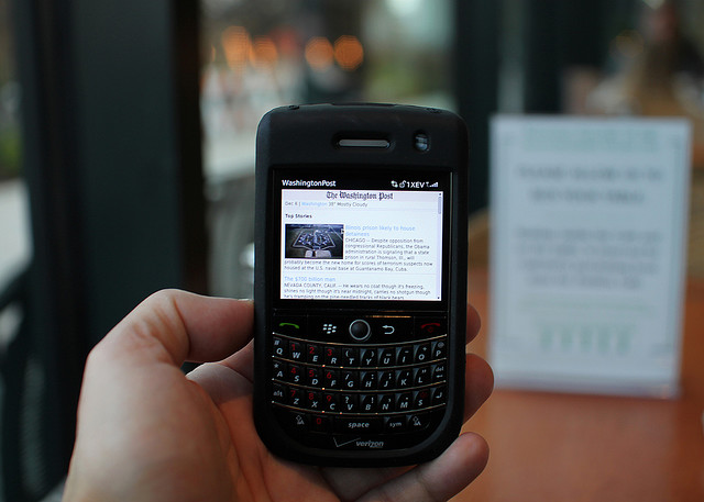
Blackberry photo by Mr. T in DC on Flickr

If you have a Blackberry, you can use Geoloqi right now. Currently, the Geoloqi app is in beta testing. The first Geoloqi app release is for iPhones running 4.0 or later, however, Geoloqi has Instamapper integration, which means that you can use Geoloqi, including sending yourself Geonotes, if you have a Blackberry or Android. The only difference is that you’ll have to use the Geoloqi.com website to leave yourself Geonotes – only the iPhone version will allow you to do it from the phone.

1. Log into http://beta.geoloqi.com and enter your phone number in the field provided. Then go to http://beta.geoloqi.com/settings/connections. Under “Geolocation Services” you’ll see “Instamapper Device Key”. Click the “Create” button. A Device Key will appear shortly afterward.

2. Install the “GPS Tracker” application from BlackBerry App World or download it over the air: http://www.instamapper.com/download/GPSTrackerBB.jad
For BlackBerry Storm, you can also try this binary with a higher resolution icon: http://www.instamapper.com/download/GPSTrackerStorm.jad

3. Start the application (look for an icon that looks like a satellite) and enter the 13-digit device key you got from the Geoloqi website.

Usage Notes:

  • Press the red hangup key to run GPS Tracker in the background.
  • Press the “Escape” key to quit tracking.
  • To have GPS Tracker start automatically when the phone boots, check “Auto-start on boot” in settings.

During the first few days of operation, the application will periodically pop into foreground. This is done to minimize the possibility that someone would use our service to track another person covertly (which is against our terms of service). Press the red hangup key to hide the application when it surfaces.

Notes on Support
All recent BlackBerries (OS version 4.2.1 and later) are supported. In particular, almost any BlackBerry bought from AT&T and Sprint should work out of the box. Note, however, that many BlackBerries do not have built-in GPS and need an external GPS receiver. Additionaly, some carriers (most notably Verizon) disable GPS access on their BlackBerries. If you have a Verizon phone, it will most likely not work. Corporate phones may also restrict access to network and/or GPS.

Enjoy using Geoloqi! If you run into any problems, or would like more information on how Geoloqi works, see Geoloqi Help. If you don’t find what you’re looking for, feel free to ask a question! We’ll be there to answer it.

Flickr photo credit: Mr. T in DC.

Posted

Thu Sep 23 2010, 12:12pm

By Aaron Parecki

Categories

Events

Tagged

Geosketching – Cyborgs are Mapping Portland

The Grassy Knoll Gallery presents:

Geosketching – Gallery Show and CyborgCamp Pre-Party

Grassy Knoll Gallery
123 NW 2nd Ave
Portland, Oregon 97209
Friday, Oct 1st, 2010 6-9 PM

Exhibition Dates // Oct 1 – 29
Artist Reception // Friday, Oct 1st, 2010 6-9 PM. Free and open to the public
Gallery Hours // by appointment
DJ set by Let’s Go Outside
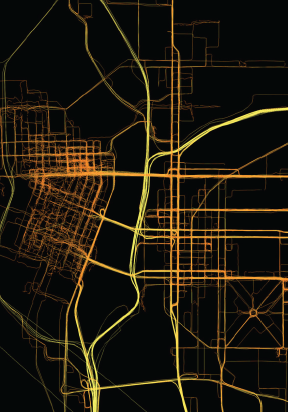
Where a person goes can reveal a lot about who they are and how they live. Thousands of people can live in the same city and have drastically different experiences.

GPS maps are a kind of technogeographical self portrait; a way of showing how one has lived during a certain period of time. The methods for taking data can reveal something about a person as well. There is no standard way of taking GPS data. One’s map may differ greatly from another. For the past two years, Aaron Parecki has been carrying a GPS tracker with him at all times, walking, busing, biking, driving and flying. Amber Case has been taking data since January 2010. Together, they have logged over 10 million GPS points. These points have been plotted onto paper, then color-coded by time of day and speed of movement to render beautiful and thought provoking prints that serve as “geotechnological” self-portraits.

Portland-based PHP developer and GPS enthusiast Aaron Parecki experiments with automatic location check-ins and proximal notification systems. He also began using GPS to control the lights in his house and perform other automated actions.

Amber Case is a Cyborg Anthropologist from Portland, Oregon. She studies the interaction between humans and computers and how our relationship with information is changing the way cultures think, act, and understand their worlds.

Together the two founded Geoloqi.com in an effort to make GPS tracking and advanced co-location protocols available to the general public.

How Can I Do This?

Geoloqi, a GPS tracker app for iPhone, Android, Blackberry and Palm is in constant development. It will allow anyone to take data and make maps like these. If you’d like to beta test or help us develop it, sign up at Geoloqi.com or follow @geoloqi on Twitter.

Geosketching will also be an opening celebration for the upcoming Cyborg Camp Portland 2010 on October 2nd.

About Cyborg Camp

CyborgCamp is an unconference about the future of the relationship between humans and technology. Topics discussed include, but are not limited to, social media, design, code, inventions, web 2.0, twitter, the future of communication, cyborg technology, anthropology, psychology, and philosophy.
For more information and to register go to portland.cyborgcamp.com or contact Amber Case.

Fashionbuddha Studio creates world-class animations and interactive experiences. Fashionbuddha Studio is featured in Communication Arts Design and Interactive Annual, how Magazine, and Best of Show at the 2009 Webvisionary Awards. www.fashionbuddha.com

About the Grassy Knoll Gallery

The Grassy Knoll Gallery began in August 2007 as a venture between Robert Lewis, owner of Fashionbuddha Animation Studio, and curator Renee Marcotte. Located on the second floor of the historic Merchant Hotel in Old Town, Grassy Knoll Gallery provides a unique outlet for illustrators and animators.

For more information on past, current and future shows or to purchase artwork online, please visit our website at www.grassyknollgallery.com.