Posted

Tue Jan 4 2011, 5:17pm

By caseorganic

Categories

Tutorials

Tagged

How to Use Geoloqi with an Android Phone

Note: Geoloqi no longer works with Instamapper

Note: This tutorial used InstaMapper, a free GPS tracking and location sharing service. After nearly 5 years of operation, the site shut down on December 13th, 2012. There are now dedicated Geoloqi apps for Android. You can now download Geonotes or Geotracks for Android.
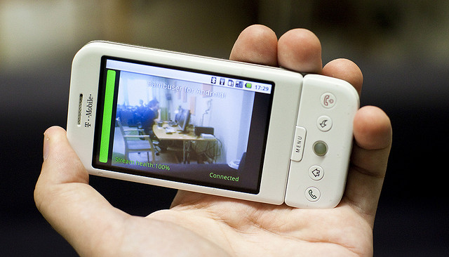
Flickr photo by tomsun

If you have an Android or Blackberry, you can use Geoloqi right now. Currently, the Geoloqi app is in beta testing. The first Geoloqi app release is for iPhones running 4.0 or later, however, Geoloqi has Instamapper integration, which means that you can use Geoloqi, including sending yourself Geonotes, if you have a Blackberry or Android. The only difference is that you’ll have to use the Geoloqi.com website to leave yourself Geonotes – only the iPhone version will allow you to do it from the phone.

1. Log into http://beta.geoloqi.com and enter your phone number in the field provided. Then go to http://beta.geoloqi.com/settings/connections.

Under “Geolocation Services” you’ll see “Instamapper Device Key”. Click the “Create” button. A Device Key will appear shortly afterward.

2. Go to the Android store on your phone and find a free app called GPS Tracker by Instamapper.

Download the app and start running it. Click on “Menu” and click on “Settings”. You’ll see a field to enter your device key that you generated on Geoloqi. Enter that key there.

The rest of the settings concern what interval you’d like the GPS tracker to track at. Setting the tracker to track every 5 seconds will wear down your battery more quickly, but it will give you a very high resolution trail to look at on your map on Geoloqi.com. Set the buffer size at 100, and don’t worry about the Units. Imperial is fine. Setting Minimum accuracy (ft) to 1000 is also recommended. This way, Geoloqi will ignore points that are less accurate than 1000ft.

General Functions:
Press the “Menu” key to bring up settings.
Press the “Home” key to run GPS Tracker in the background.
Press the “Back” key to quit tracking.

A note on battery life:
GPS is powered on continuously for send intervals less than 121 seconds. If you want better battery life, set the send interval to at least 121 seconds. This will cause GPS Tracker to go to sleep in-between updates.

From there on out, you can use all the features of Geoloqi available on the website. Click on your map to see your history, share a link with others, and send yourself a Geonote by drawing a radius on the map, writing a message, and clicking send. If you share your location with someone, they’ll get a mobile version of your trail on their mobile phone, and a web version of your trail on the web.

You can toggle your privacy options at http://beta.geoloqi.com/settings/privacy and see your list of shared links at http://beta.geoloqi.com/settings/share. All of your account settings are at http://beta.geoloqi.com/settings/profile.

Finally,if you want to quickly access your map, you can easily do so by going to http://beta.geoloqi.com/username or where the username is the id of the Twitter account you used to sign in. If you didn’t sign in with Twitter, go to the connections tab in Geoloqi to connect your Twitter account. You’ll then be able to easily access your Geoloqi account by username URL.

Additional Help
If you have more questions, see Geoloqi Help. If you can’t find what you need there, please ask a question! We’ll get to it as quickly as we can.

Flickr photo by tomsun.
How to Use Geoloqi with a Blackberry Phone

Note: Instamapper no longer supports Blackberry. This tutorial is now expired.

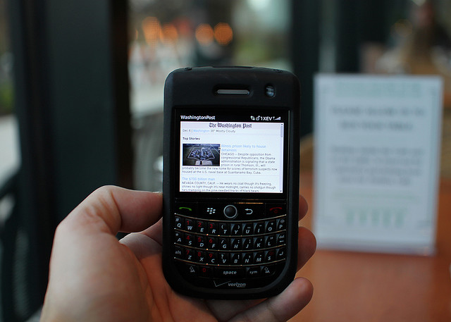
Blackberry photo by Mr. T in DC on Flickr

If you have a Blackberry, you can use Geoloqi right now. Currently, the Geoloqi app is in beta testing. The first Geoloqi app release is for iPhones running 4.0 or later, however, Geoloqi has Instamapper integration, which means that you can use Geoloqi, including sending yourself Geonotes, if you have a Blackberry or Android. The only difference is that you’ll have to use the Geoloqi.com website to leave yourself Geonotes – only the iPhone version will allow you to do it from the phone.

1. Log into http://beta.geoloqi.com and enter your phone number in the field provided. Then go to http://beta.geoloqi.com/settings/connections. Under “Geolocation Services” you’ll see “Instamapper Device Key”. Click the “Create” button. A Device Key will appear shortly afterward.

2. Install the “GPS Tracker” application from BlackBerry App World or download it over the air: http://www.instamapper.com/download/GPSTrackerBB.jad
For BlackBerry Storm, you can also try this binary with a higher resolution icon: http://www.instamapper.com/download/GPSTrackerStorm.jad

3. Start the application (look for an icon that looks like a satellite) and enter the 13-digit device key you got from the Geoloqi website.

Usage Notes:

  • Press the red hangup key to run GPS Tracker in the background.
  • Press the “Escape” key to quit tracking.
  • To have GPS Tracker start automatically when the phone boots, check “Auto-start on boot” in settings.

During the first few days of operation, the application will periodically pop into foreground. This is done to minimize the possibility that someone would use our service to track another person covertly (which is against our terms of service). Press the red hangup key to hide the application when it surfaces.

Notes on Support
All recent BlackBerries (OS version 4.2.1 and later) are supported. In particular, almost any BlackBerry bought from AT&T and Sprint should work out of the box. Note, however, that many BlackBerries do not have built-in GPS and need an external GPS receiver. Additionaly, some carriers (most notably Verizon) disable GPS access on their BlackBerries. If you have a Verizon phone, it will most likely not work. Corporate phones may also restrict access to network and/or GPS.

Enjoy using Geoloqi! If you run into any problems, or would like more information on how Geoloqi works, see Geoloqi Help. If you don’t find what you’re looking for, feel free to ask a question! We’ll be there to answer it.

Flickr photo credit: Mr. T in DC.

Posted

Sun Jan 2 2011, 7:19pm

By Aaron Parecki

Categories

API

Tagged

Minor API Changes for Anonymous Accounts


If your app is creating anonymous accounts using the Geoloqi API, there is a minor change rolling out to the API in the next couple days.

Previously, access tokens returned from user/create_anon would not expire, so no refresh token was returned. This is changing to more closely match the user/create method.

Now, access tokens will expire after the default amount of time, so you will need to store the refresh token that is returned from the create method. If you have a good reason for not wanting to manage refreshing the access token, you can request a permanent access token by using the account/permanent_token method.

Note: As with access to the create_anon method, your application will need to be pre-approved to access this method. Please email us at [email protected] to request access to this method.

Posted

Sat Jan 1 2011, 9:21pm

By caseorganic

Categories

News
Press

Geoloqi #6 on JWT’s 100 Things to Watch in 2011

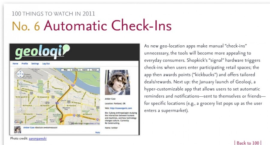
As part of their annual forecast, JWT recently released 100 Things to Watch in 2011. We were excited to find that Geoloqi was on the list as #6!

The report is a fascinating look into the future. You can see it on Slideshare and download it there as well.

In other news, we’re sending out beta invites now, and we’re looking to release the first version of the app mid-January.

Posted

Thu Dec 9 2010, 10:10am

By Aaron Parecki

Categories

Press

Forbes.com: Name To Know: Geoloqi, Foursquare’s Biggest Threat?

Geoloqi was born from its founders' experimentation with location tracking.

Meghan Casserly writes: “Lost grocery lists. Late to work. Forgotten restaurant names. All things of the past when Geoloqi launches in the first weeks of January. Grocery lists will be texted to your mobile when you enter the Whole Foods. Your boss will be emailed when the clock strikes nine and you’re not in the office—letting him know your exact location and ETA. The name of the French bistro where you met your wife will be sent to you each time you enter the right neighborhood. Anniversary awkwardness cleverly avoided.

And so, harboring a secret disdain for foursquare, I was intrigued.

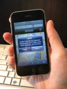
A geonote from co-founder Amber Case.

A geonote from co-founder Amber Case.

Geoloqi is a fully customizable GPS-based application that lets you set your own reminders, rules and notes based on your geographic location. Think FourSquare without the exhibitionism. Geoloqi, the brainchild of cyborg anthropologist Amber Case and her partner Aaron Parecki, will use GPS technology to map users, but not broadcast their locations to the world—only those they choose to share it with and when.

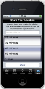
The app lets you decide how long to share your location.

“I’d like to share my location with a client if I’m meeting them somewhere, so they can know when I’ll arrive,” writes co-founder Parecki in a web presentation on the faults of other location-mapping products including Foursquare, Dopplr and Gowalla. “But after our meeting, I absolutely don’t want them to access my location. This is often true even with friends. Friends’ location is not always relevant to me. Current location-sharing systems are currently all or nothing.”

The secret of Geoloqi is that it’s a completely customizable experience. Once the app is downloaded, a user can set geonotes (SMS notes that are received when you enter a specific location), create layers (be notified anytime an apartment listing meeting your criteria is nearby), subscribe to existing layers created by other users (“For example,” Parecki says, “I’m currently subscribed to the “USGS Earthquakes” layer which means I get a text any time an earthquake happens within 200km of my current location, wherever I go.”) and, most importantly, share locations and notes at the user’s discretion—for a specific period of time.

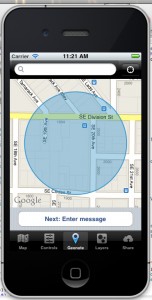
Choosing a location to leave a note.

That information can be shared with other Geoloqi users, or a link emailed or posted to Twitter or Facebook, and anyone who has the link can see your location for a limited amount of time.

“This is a very different approach to sharing than most social networks take,” Parecki points out, “Since we don’t limit to sharing with other Geoloqi users.”

The Portland-based pair of Parecki and Case has so far received no major financial backing, and Parecki says all design and development has been done by volunteers who are helping out because they are “very interested in project.” Pricing for the application, which will be released as a public beta in January and will be available at the app store has not been finalized.

With no millions of VC money to prop them up, I wondered to Parecki how Geoloqi hopes to be self-sustaining in the year to come, and his response was far from the advertising-based answer I expected. “We plan on licensing the iPhone software development kit to developers who want to integrate location into their own apps,” he told me. “Also we will likely charge developers for heavy application programming interface access if they go over a certain threshold.”

Read the full article on forbes.com.